
When I was a child, I had a full set of Nagatanien’s Fifty-three Stages of the Tokaido cards at home. Since then, I have been interested in the Tokaido Highway and wanted to walk it someday.
Even a journey of a thousand miles starts with a single step. If you don’t start walking, the opportunity to walk will never come.
So, I decided to start walking today.
Nihonbashi
The guidebook says, “Once upon a time, travelers left around 4 a.m.”.
But I arrived at Nihonbashi at around 07:30. It would be difficult to even walk 30 kilometers, as I haven’t been walking much lately. I think I’ll walk about 25 kilometers at most and come back quickly while it’s still light.
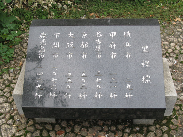
Distance display
Since it was a good opportunity, I decided to take a careful look at the plaza of the original marker. The distance display said that the distance to Kyoto was 503 kilometers. If I walked 40 kilometers a day, it would take me 13 days. That’s a long way.

100 Best Roads in Japan: Chuo-dori Avenue
The Tokaido Highway (Chuo-dori Avenue) that I am about to walk has been selected as one of the 100 best roads in Japan. As you can imagine, this is the only street you can’t miss, as it is the starting point of all roads in Japan.

Nihonbashi
I took a picture of Hiroshige’s Ukiyoe and the current Nihonbashi at the same time, and I was off.
The guidebook says that there is a monument to the birthplace of Ginza right after I leave. But I’ve already missed it. Since I didn’t want to go back and there would be many landmarks I would miss, I decided to keep going.
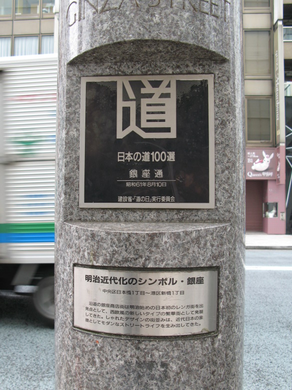
One hundred best roads in Japan: Ginza-dori
I found yet another monument honoring the 100 best roads in Japan! At this pace, I’m sure I’ll be able to find all 100 by the end of the day.
It’s “Ginza-dori” without a forwarding kana.
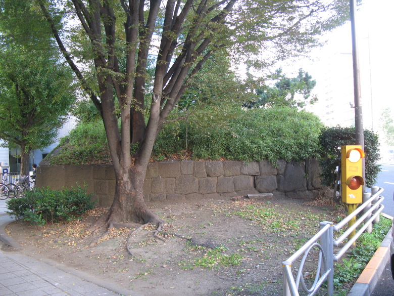
Ruins of Takanawa Ookido
About an hour and 40 minutes after my departure, I came to the Ruins of Takanawa Ookido. I was amazed at how the stone walls have been carefully preserved in the middle of the city.
I had only walked 5-6 kilometers, but my legs were already showing signs of fatigue. I might be in trouble
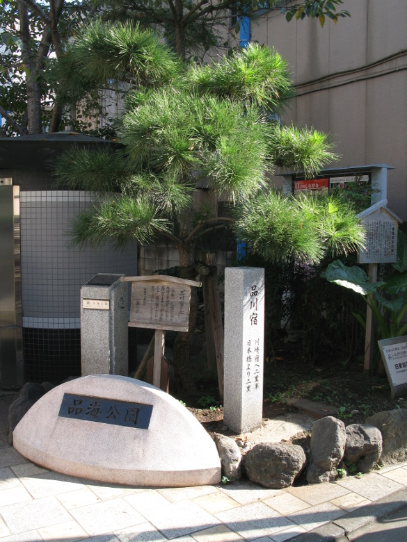
Shinagawa-juku
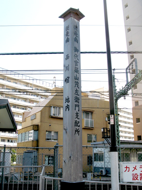
Boundary stakes in Shinagawa-juku
Shinagawa-juku begins about where the Yamanote line separates from the rest of the city. At the entrance, there is a signpost. It stirs up a sense of travel.
The second Ichirizuka
About 2 hours and 20 minutes after my departure, I found the monument of the second ichirizuka. However, it is said that this ichirizuka did not already exist in the middle of Edo period.
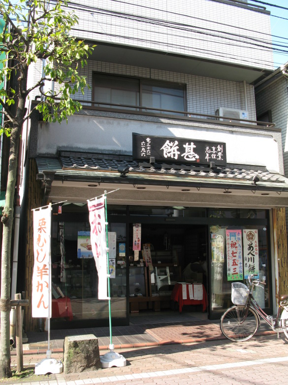
Mochi Jin
Between Heiwajima Station and Omorimachi Station, I found a long established Japanese confectionery called Mochi Jin! It was founded in 1715.
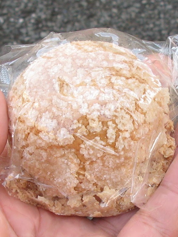
Mihara Musume
I entered the store and bought a “Mihara Musume,” which had a slightly different appearance. It was a pastry made of cookie dough wrapped with white bean paste, and it was delicious. Mihara seems to be the name of a nearby street. I wonder if they have any “Tokaido Musume.”
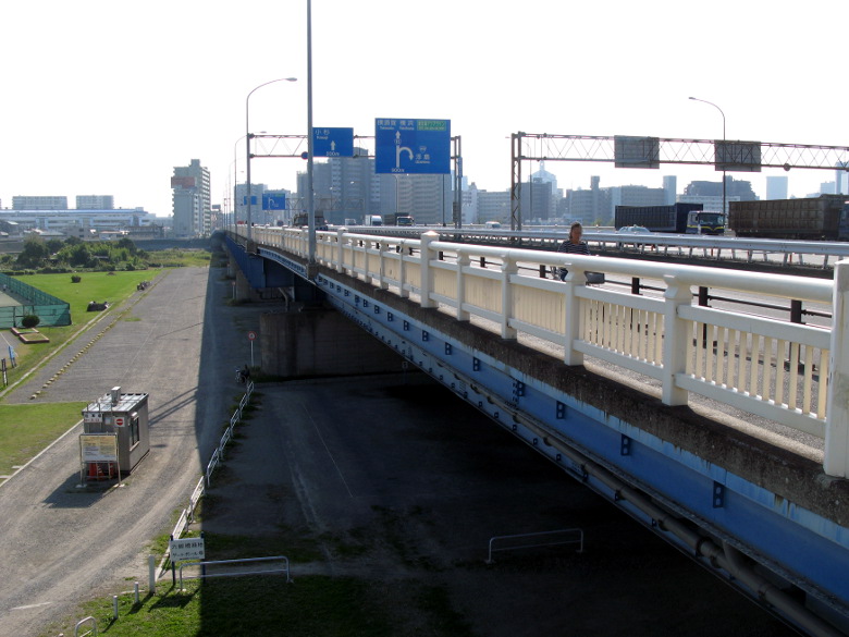
Rokugo
It took us about five hours from the time I left to reach the Tama River. The Hakone Ekiden takes about an hour, so they were running five times faster than walking.
In the old days, they used to cross the Tama River on a ferry. Today, it is crossed by the Rokugo Bridge.
Kawasaki-juku
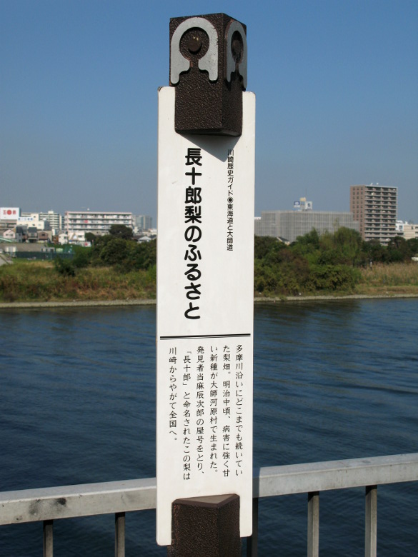
Home of the Chojuro pear
In the Edo period (1603-1868), there was a shop on the Kawasaki side called Mannenya, which was famous for its Nara chazuke. Today, a signboard displaying “Home of Chojuro Pear” has been constructed. But I couldn’t find any ochazuke shops or pear orchards in the vicinity.
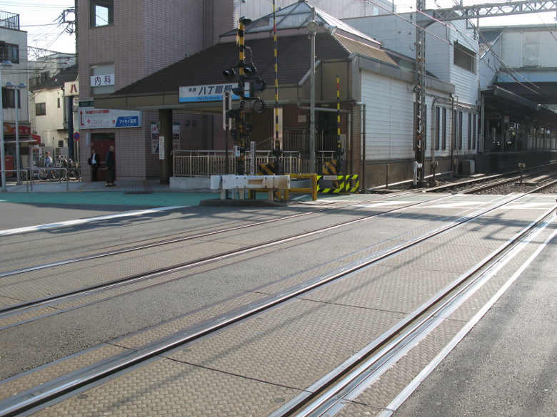
Railroad crossing in front of Hatchonawate Station
I cross the railroad crossing in front of Hatcho-nawate station.
The word “nawate” means a long straight road or a path in the rice field. In this case, it probably means the former. 8 chou is about 872 meters. In fact, it’s about 2.9km long with a slight curve. The railroad tracks also crossed at an angle, probably because they wanted to go straight and did not give way to each other, which is a little strange.
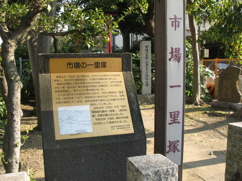
Shijou itirizuka
I found Shijou itirizuka, 5 ri (19.65 km) away from Nihonbashi! It said that the mound on the left was the only one still existing, but as I was a beginner at ichirizuka, I wasn’t sure which one it was.
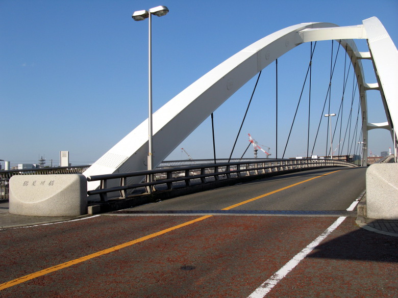
Tsurumi River Bridge
I cross the Tsurumi River Bridge. It is narrower at the top and has a modern form. Incidentally, the first Tsurumi River Bridge was built around 1601.
Kanagawa-juku
The area around the spot where the Namamugi Incident occurred was under construction and the monument was moved, so I couldn’t find it!
It’s a pity, because I’ve been curious about this place ever since I learned about the Namamugi Incident from Ryotaro Shiba’s novel 20 years ago.
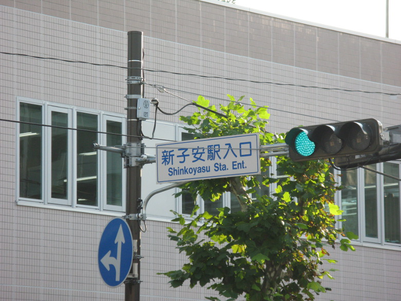
Shinkoyasu Station entrance intersection
Arrived at the Shinkoyasu Station entrance intersection. This was the end of my first day.
After a mere 26km or so, my thighs were all tense.
I was lucky enough to be able to sit on the train on the way back. But every time I stood up to change trains, I felt intense pain. I am a little worried about whether I will be able to walk the entire Tokaido Highway someday.
Walking data
Course: JR Chuo Line Kanda Station -> Nihonbashi -> Shinagawa-juku -> Kawasaki-juku -> Kanagawa-juku -> JR Keihin Tohoku Line Shin-Koyasu Station
Distance: 26.5km
Time: 7h33m
*Tokaido Network no Kai 21: Kettei-Ban Tokaido Gojusantsugi Guide, Kodansha + Alpha Bunko, 2005.

コメント