Itabashi-juku
The Gateway to Grandma’s Harajuku
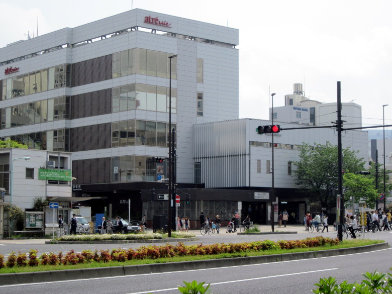
Today we will walk along the Nakasendo road from Sugamo Station.
Sugamo is known as Harajuku for grandmothers, and the station building is very modern.
Passing by Koiwaji Temple, famous for its Togenuki Jizo, and crossing the Saikyo Line crossing, I reached Itabashi-juku, the first inn on the Nakasendo.
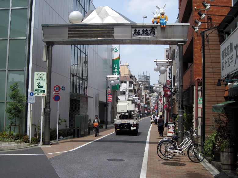
Itabashi-juku entrance in the style of a kabuki gate
From about the point where I crossed Route 17, I could see the sign of Itabashi-juku, and a busy shopping street followed. I had imagined Itabashi to be just a residential area, but the atmosphere was different in a good way.
There are many signs here and there that are maintained by the Itabashi-juku Fudo-dori Shopping Street Promotion Association and the Itabashi Tourism Center, showing that the entire town is committed to preserving the atmosphere of the inn town. I felt the same way at Shinagawa-juku on the Tokaido Highway.

Itabashi Bridge
About a kilometer from the national highway intersection, I found Itabashi Bridge, the origin of the place’s name! It is said to be 2 ri 25 cho 33 ken (10.642 km) from Nihombashi. In such a case, do they measure the distance from the middle to the middle of each bridge? The bridge was decorated with carp streamers (Koinobori) for the season.
The river flowing underneath is the Shakujii River. It is a major river that has created the topography of the northeastern part of Tokyo. However, the flow rate is not that high.

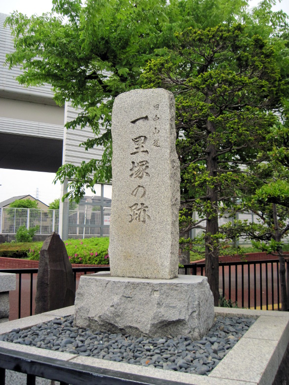
Shimura Ichirizuka
The next one was Shimura Ichirizuka, located on both sides of the road. It is magnificent.
I heard that there are only two Ichirizukas in Tokyo, one here and one in Nishigahara.
Nishigahara is the second Ichirizuka on Nikko Onarimichi. I’m going to go there next time.
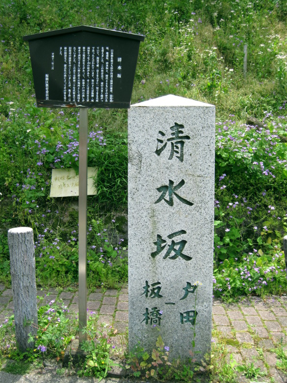
Shimizu-zaka Slope, a difficult place to go
From here, it’s a downhill called Shimizu-zaka slope. The signboard says it’s the first difficult part after leaving Nihonbashi. Is it even a downhill slope? I can understand if it is the last difficult point when coming from Kyoto. The elevation difference is about 16 meters.
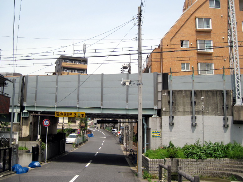
Passing under the Toei Mita Line
I pass through the guard of the Toei Mita Line. The Mita Line is a subway line, but because of the sudden change in elevation, it has gone above ground.
It was lunchtime, so I ate my lunch on the right bank of the Arakawa River. The big river is soothing to the soul.
After crossing the Toda Bridge, I saw the Toda Rowing Center (Soteijo). I liked the scenery quite a bit, but somehow I forgot to take a picture.
Warabi-juku
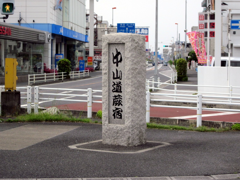
Entrance to Warabi-juku
About 2.3 km from the Arakawa bridge, the road splits off from Route 17 and turns into the old highway.
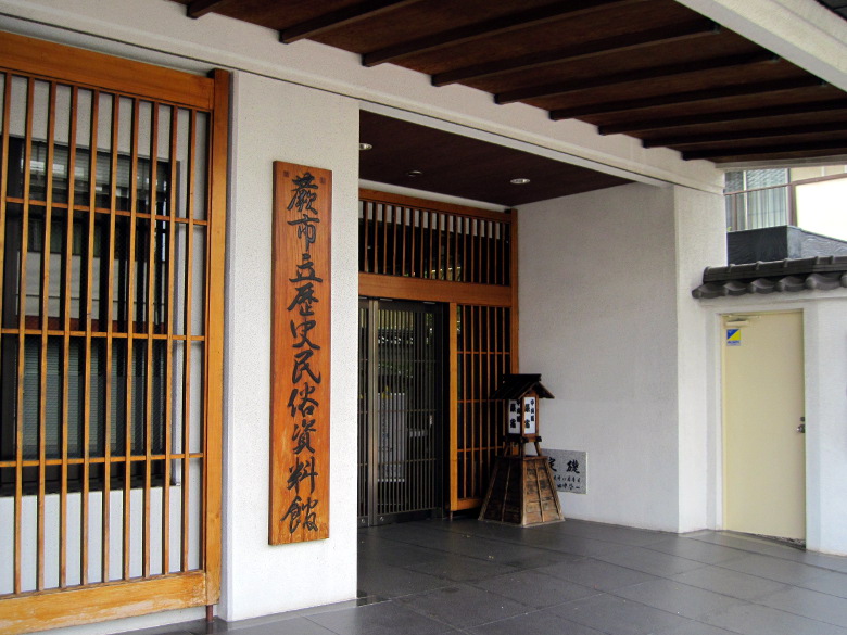
Warabi City Museum of History and Folklore was closed
There was a branch library of the History and Folklore Museum. However, it was closed today because it was Constitution Memorial Day. I wanted to enter the museum because it seemed to have various exhibits about Warabi-juku.
Ichirizuka of Tsuji
I found the Tsuji no Ichirizuka. If they had put up a nice stone monument, I would have liked to see something like “Ichirizuka of Tsuji” or “5 ri from Nihonbashi”.
Urawa-juku
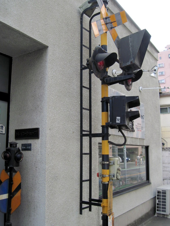
Mysterious Crossing
Between Route 463 and the Tohoku Main Line, there was a railroad crossing in front of the building. Why here?
Apparently, it was a model train shop. I was a little surprised.
Walking data
Course: JR Yamanote Line Sugamo Station → Itabashi-juku → Warabi-juku → Urawa-juku → JR Tohoku Main Line Kita-Urawa Station
Distance: 21km
Time : 5h11m


コメント