I found the Sakuragawa Rooftop Park. It’s a beautiful park where you might want to eat your lunch or read a book. There were only a few people there, so it seems to be a lesser known place.
Hatchobori
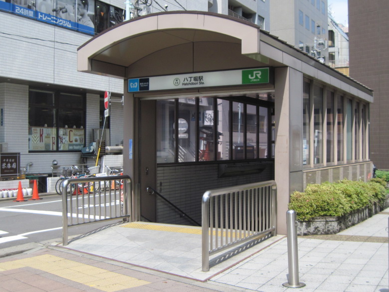
Hatchobori Station
I departed from the station named after Hatchobori, which often appears in historical dramas.
The moat itself has been reclaimed and no longer exists.
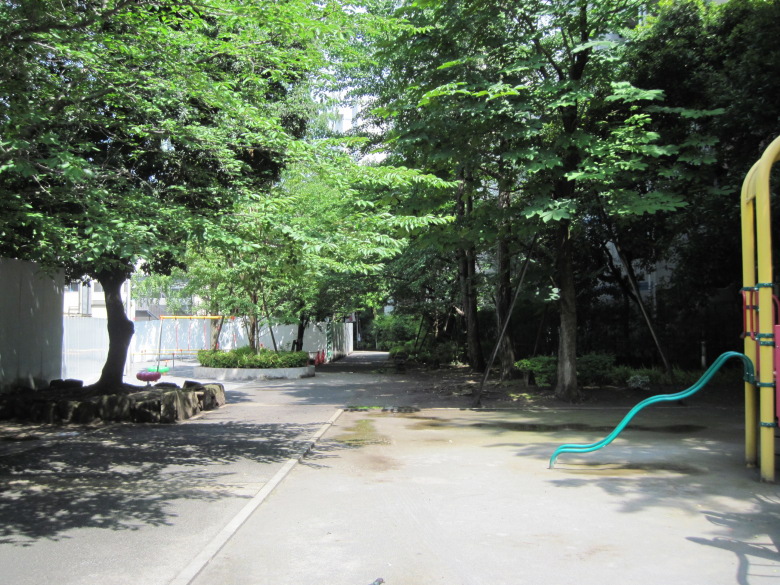
Sakuragawa Park
As I started to walk, thinking it was a pity that the moat had been filled in, I saw a sign saying that Sakuragawa Park was created after the Hatchobori moat was reclaimed.
When I looked around again, I felt the atmosphere of the Edo period…
I can’t feel it at all. However, there is a lot of greenery.
At the end of Sakuragawa Park, there was a towering building.
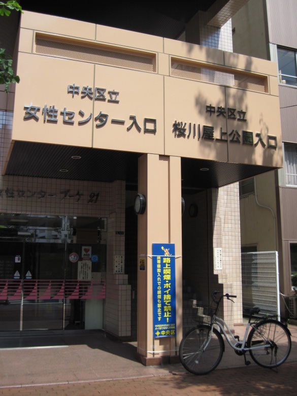
Entrance to Sakuragawa Rooftop Park
There are the words “Sakuragawa Rooftop Park Entrance” on it. I have to go there.

Sakuragawa Rooftop Park
This is what the rooftop park looks like. It doesn’t look like a rooftop at all. It reminds me of Hatchobori (?), and you can hear the murmuring.
If I had a place to work nearby, I would like to visit this park often for refreshment.
I was a little disappointed that the soles of my shoes were slippery after the rain.
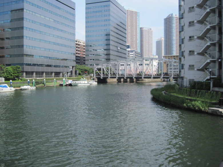
Kamejima River
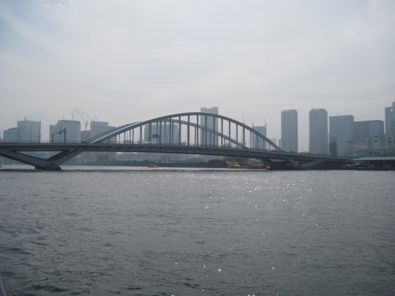
Coming down from the rooftop park, I saw the Minami-Takahashi Bridge that I wrote about last week.
There are a number of boats tied up in the Kamejima River.
Reigishijima, on the other side of the river, was famous for its wealthy merchants. I guess many rich people still live there and enjoy boating.
Teppozu-Inari Shrine
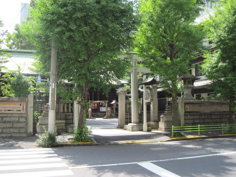
Teppozu Inari Shrine
Last week I walked along the street closest to Sumida River, so today I walked along the street one or two streets away from the river. Then I found the Teppozu Inari Shrine, with its cogon grass ring. I’ve been living for decades, and just two weeks ago I passed through a cogon grass ring for the first time in my life, and now I have the opportunity to do it again. The shrine didn’t indicate how to go through it, but I went through it according to the etiquette and paid my respects.
Because I was in such a high mood from the cogon grass ring, I missed the famous Fuji mound in this shrine. What a pity. I wonder when I will pass by here next.
Incidentally, there are two explanations for the name “Teppo”: one is that the island here was shaped like a gun, and the other is that cannon firing exercises were held here during the Kan’ei era.
Tsukishima
Tsukuda Bridge
Crossing the Tsukuda Bridge. On the other side is Tsukishima, famous for its monja. It’s delicious, isn’t it? Monja.
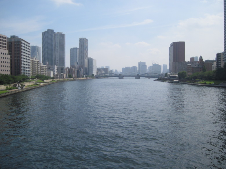
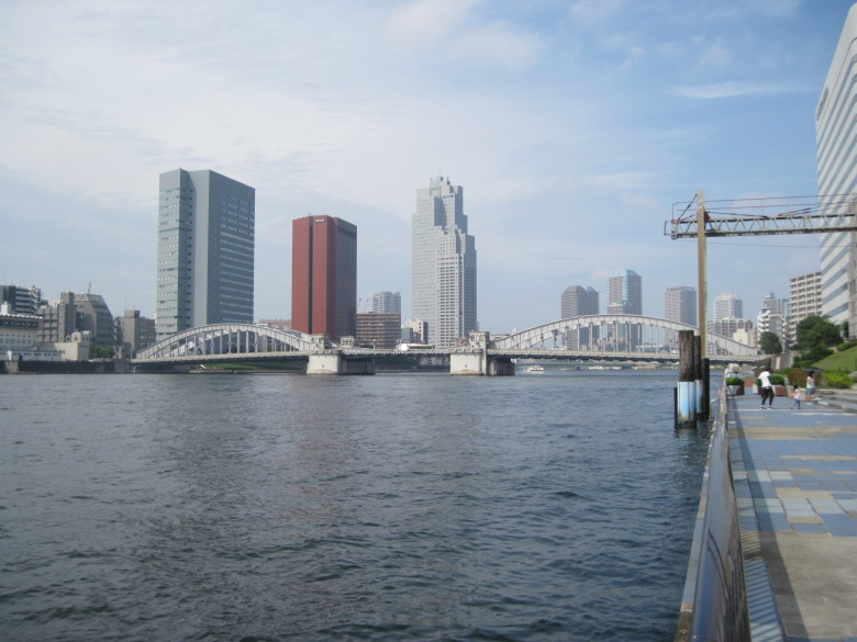
Kachidoki Bridge and Tsukiji Bridge
Looking downstream, you can see three arches. The arches on both sides are the arches of the Kachidoki Bridge, and the middle arch is the Tsukiji Bridge beyond.
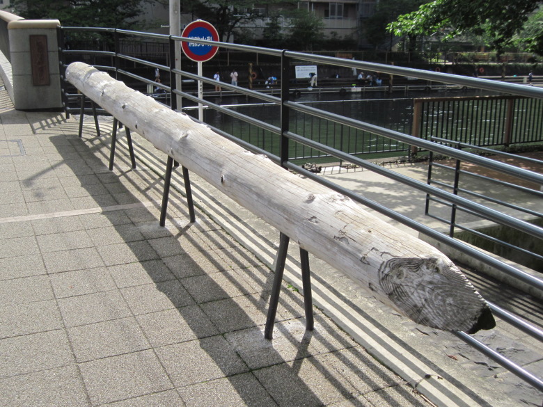
Wooden piles of the foundation of the previous Nishinaka Bridge
The area between Tsukishima and Kachidoki is divided by the Tsukishima River. Currently, the Nishinaka Bridge, built in 2014, spans this Tsukishima River.
The rice pines shown in this photo are the wooden piles that were used as the foundation of the previous Nishinaka Bridge. But how come it hasn’t rotted after being used underwater for almost 60 years since 1956? Was there too little oxygen in the water for it to rot?
But there’s never no oxygen in the water, is there? There are a lot of people fishing on the other side of the river. Have they already started catching goby? Most of the people seemed to be reel fishing.
The mouth of the Sumida River
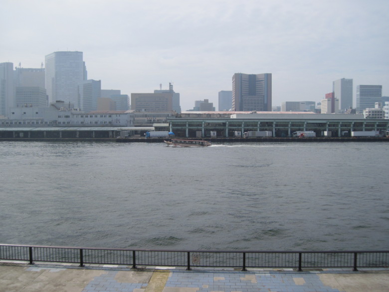
Tsukiji Market
Tsukiji Market. It hasn’t been moved yet.
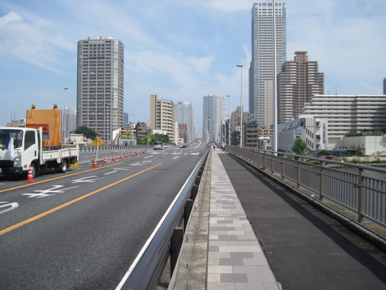
Kachidoki Bridge
Looking to the right is the Kachidoki Bridge. I won’t cross it today, but I will definitely do it next time.
Tsukiji Bridge
Looking to the left is the Tsukiji Bridge. There is no sign of anyone passing through. It seems that it will not be opened until the market is moved from Tsukiji to Toyosu.
Incidentally, according to the Sumida River Basin River Improvement Plan published by the Tokyo Metropolitan Government, the downstream end of the Sumida River is located at “Kachidoki 3-chome, Chuo-ku” and “Tsukiji 5-chome, Chuo-ku” on the left and right banks, respectively. In other words, from Tsukiji Bridge to the front is the Sumida River, and beyond that is the ocean. A small part of the Tsukiji Bridge on the right bank seems to be on the Sumida River, so I guess the first bridge was moved from the Kachidoki Bridge to the Tsukiji Bridge.
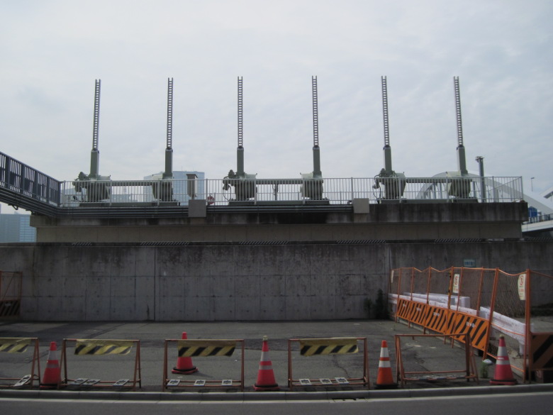
Equipment of unknown use
I passed under the Tsukiji Bridge. Beyond the embankment was Tokyo Bay.
There were six pieces of equipment lined up there that I couldn’t figure out what they were for.
A fishing machine? A flag hoisting tower? What are they? I really don’t know.
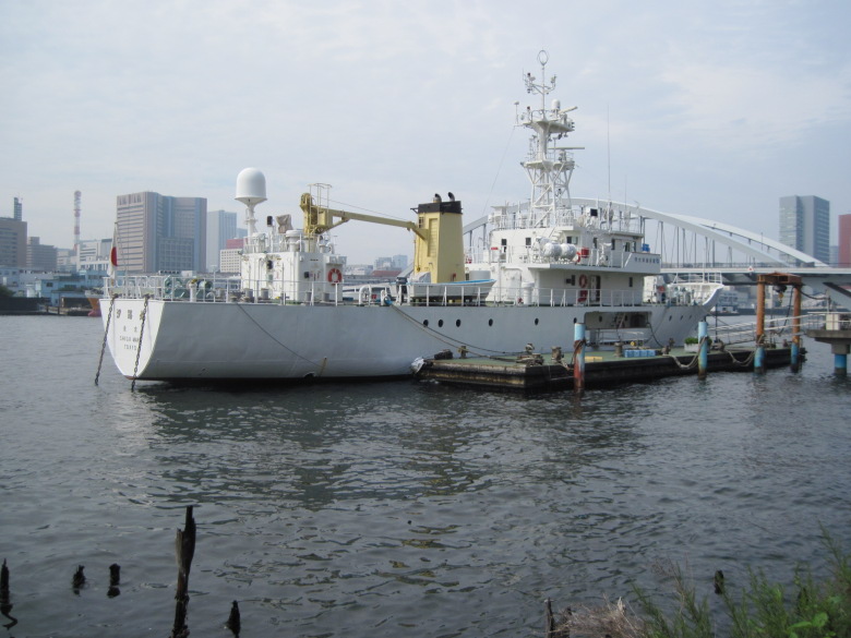
Shioji Maru
The Shioji Maru, a training ship of the Tokyo University of Marine Science and Technology, is moored here.
The Mitsubishi Maritime Academy, the predecessor of the Tokyo University of Marine Science and Technology, used to moor the Seimyomaru downstream from the Eitai Bridge to serve as its school building. I wonder if it was just like this in terms of image.
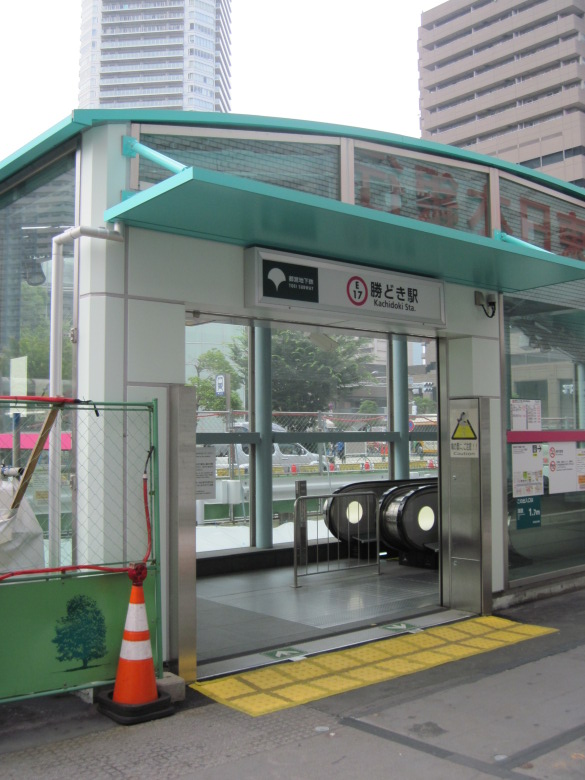
Kachidoki station on the way home
With this walk, I’ve stepped over the Sumida River.
However, I want to cross the Kachidoki Bridge, so I will come back soon.
Walking data
Course: Tokyo Metro Hibiya Line Hatchobori Station -> Sumida River -> Toei Subway Oedo Line Kachidoki Station
Distance: 4.9km
Time: 1h20m

