
Gondazaka is a slope often heard of during the Hakone Ekiden. I turned right at a certain point and entered a narrow road, which was the entrance to Gontazaka, and I felt like I had been caught off guard. From there, it takes about 1,300 meters to ascend about 67 meters. From the top of the hill, I could see Mt. Fuji.
Kanagawa-juku
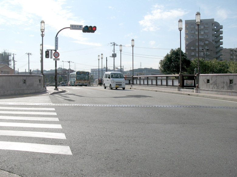
I start walking from the Shin-Koyasu Station entrance intersection, where I reached yesterday.
I’m surprised to find that I’m not as tired as I thought I would be. I’m still young.
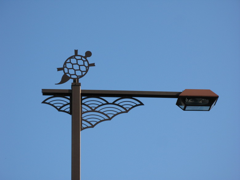
Blue ocean wave and turtle design
The area near Kanagawa Station is the site of the legend of Urashima Taro, and the streetlights are designed with blue ocean waves and turtles.

Entrance to Miyamae Shopping Street
The Miyamae shopping street that you might pass by if you’re not careful is the Tokaido. From here, it is uphill.

Tanaka-ya
In the middle of the hill there was a restaurant (Tanaka-ya) where Oryo, wife of Ryoma Sakamoto, worked. The predecessor of Tanaka-ya was the inns “Sakura-ya,” which is also depicted in Hiroshige’s ukiyoe.
By the way, Hiroshige’s Ukiyoe shows the sea. However, the sea is not visible today. Although global warming has been a topic of discussion lately, it must have been much warmer in the Edo period and there must have been a large scale sea advance.

CAMASTRA
It was almost time for my morning snack, and I was getting hungry. Attracted by the mural, I went into a bakery called “CAMASTRA” and bought three pieces of bread. I thought that Tokaido and bread don’t go well together, but I enjoyed them as I walked.

Relief of the Old Tokaido Highway
When I am walking, I sometimes see the “Old Tokaido” sign. I appreciate it because it reassures me that I am not going the wrong way. But what is this symbol illustrating?

Junction with Hachioji Road
A little before the Matsubara shopping street, there is a junction with the Hachioji Road. Route 16 seems to be a national highway built along this Hachioji Road.

Matsubara Shopping Street
The entrance to the Matsubara shopping street. Even though it was a Tuesday on a weekday, there was a lot of excitement in the Matsubara shopping street. I almost forgot to take a picture.
Hodogaya-juku

Ruins of Katabira Bridge
After crossing Tennocho Station, I came to the remains of the Katabirabashi Bridge. It is said that this place is depicted in Hiroshige’s “Hodogaya”, but the surrounding scenery has changed a lot.

Mr. Topknot
I found “Mr. Topknot” at a car stop on the sidewalk. On his back, he is carrying the Yokohama City mark consisting of the two letters “Hama”. This mark was created in 1909, so it is possible that someone really wore a kimono with this design back then.

Remains of Hodogaya’s Ichirizuka
Just after crossing the railroad tracks at the end of Hodogaya station, I turned right almost at a right angle to find eighth Ichirizuka. Nearby elementary school students were there to study social studies. I was jealous that they could take classes while touching actual historical objects. If I had lived here, I might have liked Japanese history more.

Gonzaga slope
The entrance to Gontazaka is at a place where you might think, “What? From there, the slope goes on and on.

Distant view of Yokohama
As I was walking up Gontazaka, I got a good view of Yokohama.

Mt. Fuji from the top of Gontazaka
I found Mt. Fuji at the top of the climb! It seems that Hokusai’s “Hodogaya” was composed from this area, looking at Mt. Fuji.

Shinano Ichirizuka
About 600 meters from there, I reached the ninth, Shinano Ichirizuka. Ichirizuka still remain on both sides of the road. The mounds are unusually large, with many trees growing on them, and I think it is worth seeing the power of these mounds. It is near Higashi-Totsuka Station. However, the mounds are so big that I couldn’t really understand their structure.
Totsuka-juku

Ruins of Yoshida Ichirizuka
One hour and 18 minutes after Shinano Ichirizuka, I arrived at the tenth, Yoshida Ichirizuka!
In the old days, people walked about 10 miles a day. So, the distance from Nihonbashi to here is about one day’s walk. But in my case, it took me more than a day and a half between yesterday and today. Also, it took me more than an hour to walk one mile, which is slower than 4 km/h. I think I should walk a little faster.
Yoshida Ohashi Bridge
I came to Yoshida Ohashi Bridge, a little before Totsuka Station. This place is said to have been the subject of an ukiyoe painting by Hiroshige. Unfortunately, there was no signboard for “Komeya” as depicted in the picture.

The junction to Dojo-zaka
From the pedestrian bridge, you can see the junction where Route 1 forks into Dojo-zaka. The road with a line of cars heading toward the back is the road to Dojozaka.
Fujisawa-juku
On the way to Dojo-zaka, there was Yugyo-ji Temple, but I was too tired to visit it, so I just walked down.

Yugyouji Bridge
When you reach the Sakaigawa River, don’t cross it right away, but turn right and follow the river for a bit, then turn left and cross the Yugyoji Bridge. Is this also a kind of Kaginote (section of road that is curved on purpose as a defensive measure)? Incidentally, the Yougyoji Bridge is also depicted in Hiroshige’s Ukiyoe.
It was getting dark by now, so I decided to end the second day here. It was about 800 meters from the Yugyoji Bridge to Fujisawa Station, which felt very far. I didn’t have any blisters on my feet, but both my thighs were very sore.
Walking data
Course: JR Keihin Tohoku Line Shin-Koyasu Station -> Kanagawa-juku -> Hodogaya-juku -> Totsuka-juku -> Fujisawa-juku -> JR Tokaido Line Fujisawa Station
Distance: 24.6km
Time: 6h47m


コメント