Having a big park near your house is very useful for taking a walk and relaxing, isn’t it? I used to live a couple of minutes walk from a big park, and I used to be happy to say that it was my own yard. But now, it takes me 20 minutes by bicycle to finally reach the park. I wish it was closer to me.
On this walk, I discovered a large planned park in Takaido.
Inokashira Park
Having walked the lower reaches of the Nihonbashi River and the Kanda River the week before last and the week before that, I decided to make a change and walk the uppermost reaches.
The source of the Kanda River is the Inokashira Pond, so I got off at the nearest station, Kichijoji. The Keio line has changed so much that it was difficult to get out at the park exit.
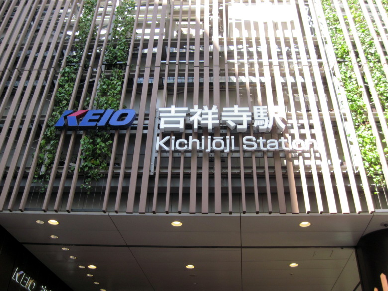
Kichijoji Station Park Exit
After leaving the station, I looked back and saw that it was KEIO Kichijoji Station and I couldn’t see any JR sign. Has it always been like this?
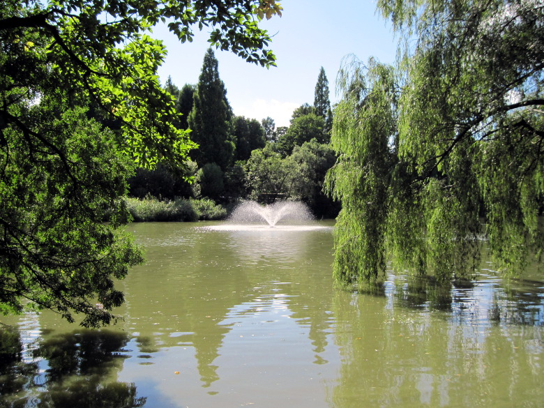
Inokashira Pond, where trees are leaning into the pond and causing blue-green algae to grow
Inside Inokashira Park, there are street performers and magicians performing tricks here and there. The trees are so thick that it is relatively comfortable even without a hat.
It seems to be the policy of Inokashira Park to grow trees leaning in the direction of the pond. There is also a large amount of blue-green algae in the pond.
I remembered that there was a spring of water at the west end of the pond, so I decided to go around the pond counterclockwise.
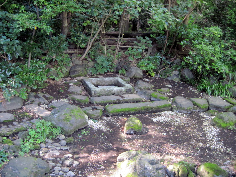
Ochanomizu, the source of the Kanda River
There it is. Ochanomizu. This photo was taken from the Ochanomizu Bridge. The spring water flows under the Ochanomizu Bridge and into the Inokashira Pond.
Ochanomizu was praised by Tokugawa Ieyasu as the best water in the Kanto region. However, it does not seem to be gushing now. I have heard that the water around this Mitaka City is hard, and I have also heard that soft water is better for tea. I’m wondering how hard this famous water is. I am also wondering if it has anything to do with Ochanomizu Station on the Chuo Line.
Upper reaches of the Kanda River
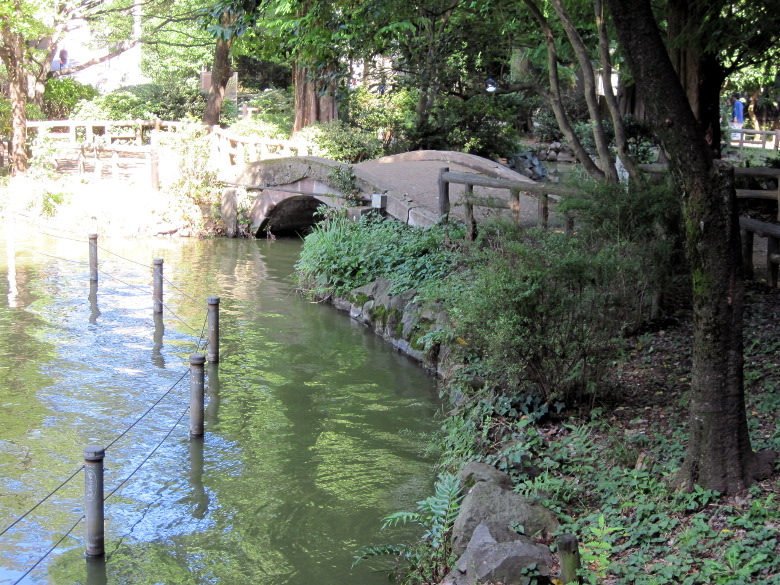
Hyotan Bridge
We came to the Hyotan (gourd) Bridge. From here, the Kanda River starts via a small pond called Hyotan-ike.
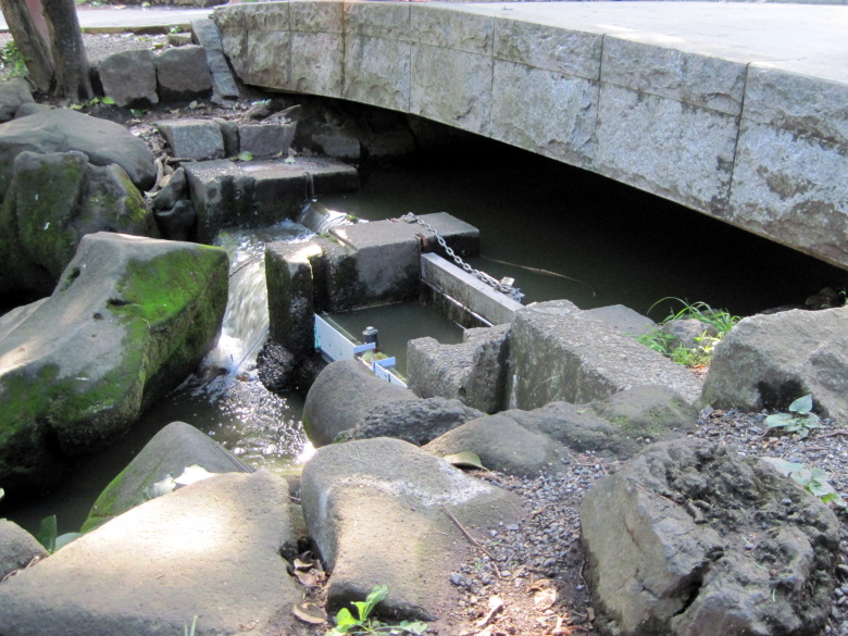
Suimon Bridge, the source of the Kanda River
This is the Suimon Bridge. Finally, the starting point of the Kanda River. It looks like the water can be dammed up. I wonder if they close the gate when the water level of Kanda River is high. But today’s water level is not very high.
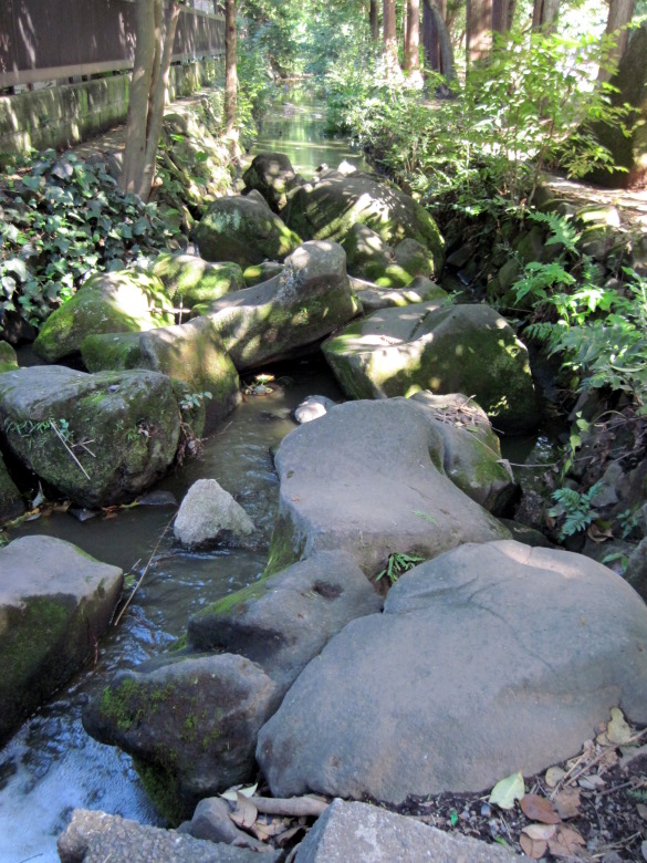
The headwaters of the Kanda River look like a mountain stream, but with blue-green algae
At the beginning of the stream, the stones are arranged in such a way that it looks like a small mountain stream. But the water is blue-green algae colored.
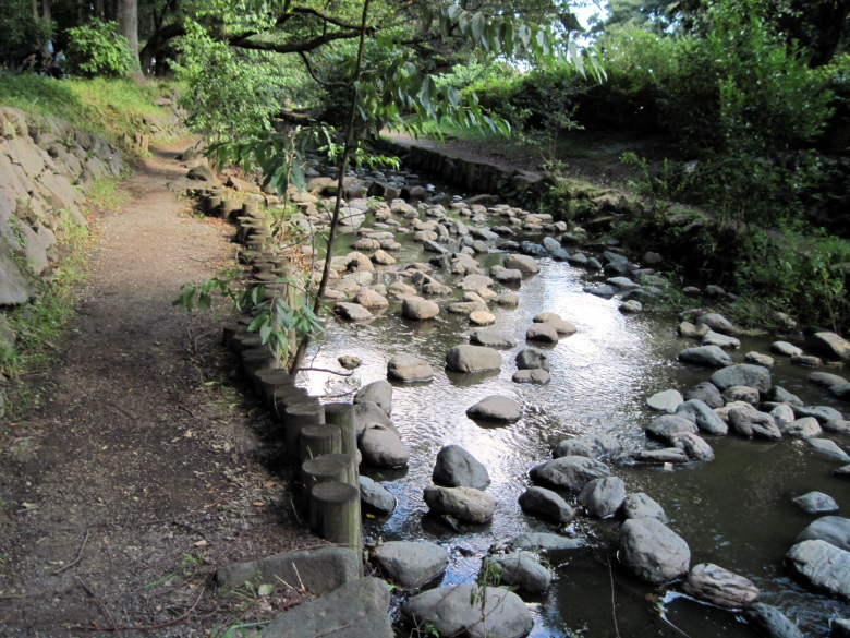
The Kanda River has widened slightly
A few hundred meters downstream, the river widens. The water was shallow, so there were many children playing in the water.
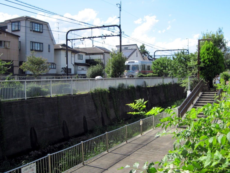
Kanda River and Inokashira Line
The Inokashira Line runs alongside the Kanda River up to the Meidaimae area. The difference in elevation is relatively small, which makes it easy to run the line.
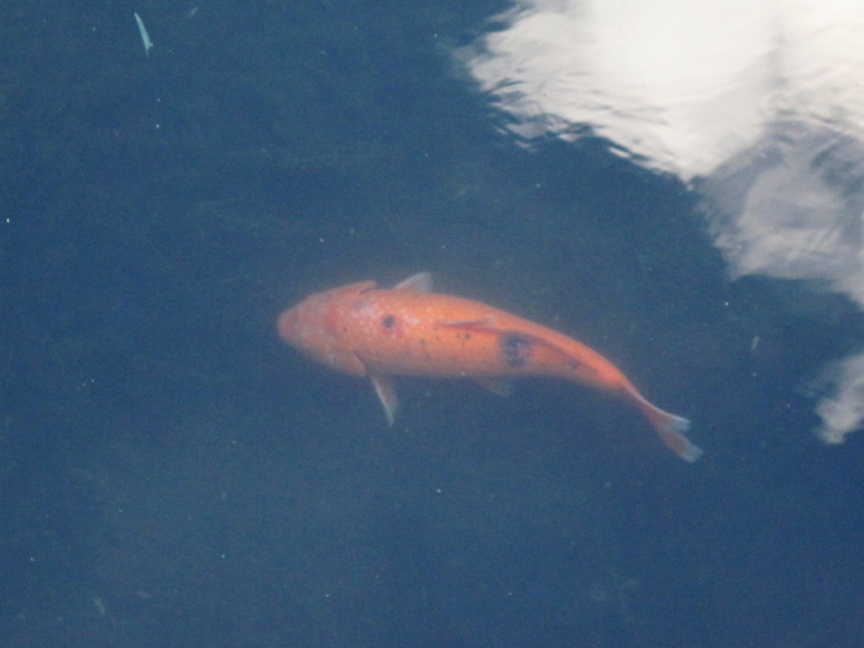
Nishikigoi found in Kanda River
In the Kanda River, there are many carp that were released to control the Eurasian watermilfoil. There are also Nishikigoi swimming in the river.
The river gradually becomes clearer and clearer. This is probably because fish and aquatic insects feed on the algae. Of course, I also think that the turbidity is diminished by the inflow from the surrounding areas.
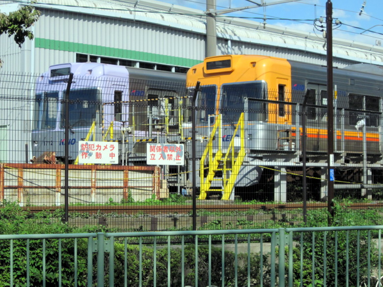
Fujimigaoka inspection area, where you don’t have to be a railway enthusiast to want to take a picture
This is the Fujimigaoka inspection area. Even if you’re not a railway enthusiast, you’ll want to take a picture.
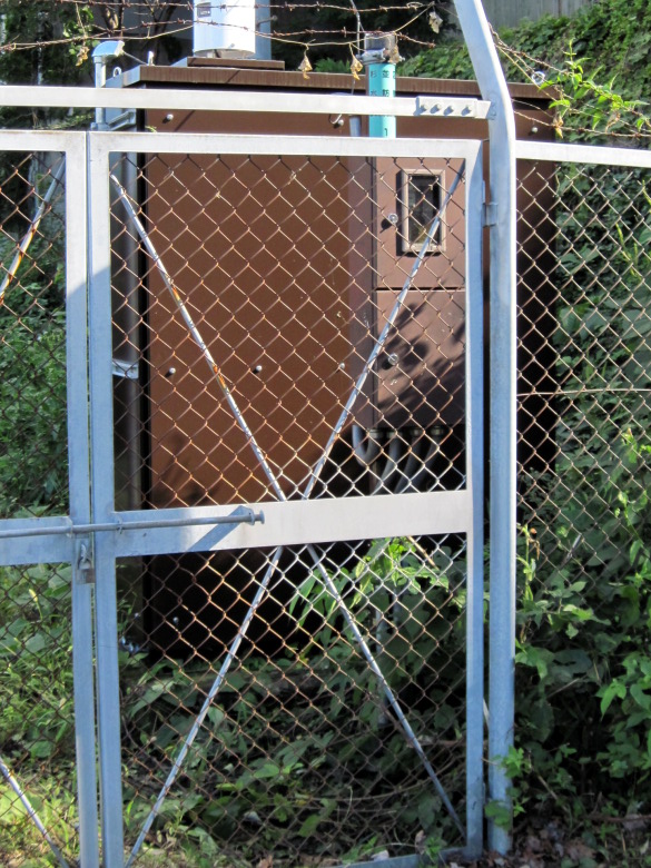
River water level alarm system
I found a warning device for river level. I wondered if the water level in the upper reaches of the river near Kugayama was ever high enough to warrant an alarm.
The walkway along the river ended at this point. The stairs forced me to leave the river.
I climbed up to a residential area. I didn’t want to look at the map, so I wondered if it would be okay to turn around here, but someone came from the other side and said, “This road is a dead end. I wonder if it’s safe to turn around here.” I must have been walking in a way that made me look like an obvious stranger. But it turned out that he was also a person who had been strolling along the Kanda River.
Found the planned site of Takaido Park!
After passing through a residential area, I came upon a strange scene. Even though it was in a prime location in Suginami Ward, there was a wire fence all along the road and weeds were everywhere. I thought I had found a land with a history…

Weed-infested land in the prime location of Suginami Ward
I found the site of the planned Takaido Park!
pment will be used to excavate the site and survey the relics and remains. But isn’t it hard for ordinary people to understand what a “backhoe” is? It would have been easier to understand if it said “hydraulic excavator. Anyway, won’t using a backhoe to excavate destroy ruins and remains? Am I the only one who has an image of excavation by hand, using brushes and strokes?
The planned Takaido Park site is divided into (1) the east side of the north area, (2) the west side of the north area, and (3) the south area. For (1), the plan is to conduct the main survey of buried cultural properties from June 28, 2017 to the end of March, 2018, and the park improvement work from fiscal year 2018 to fiscal year 2019. As for (2) and (3), they will conduct a trial digging survey of buried cultural properties in fiscal year 2017 and then decide the schedule for the future.
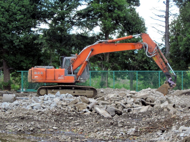
Backhoe
After a short walk, we saw four or five backhoes.
I’m looking forward to the completion of Takaido Park. When it’s completed, people in the area will be able to use two big parks, Takaido Park and Inokashira Park, which I envy.
*)Here is the status as of June 30, 2019.
Near Takaido Station
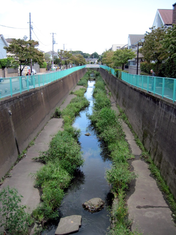
Kanda River from near Tsukimi Bridge
Turn north in front of Fujimigaoka Junior High School to return to the Kanda River.
This is a view of the Kanda River around here.

The chimney of the Suginami Cleaning Plant, which stands out even from a distance.
I am approaching Takaido Station. This chimney of the Suginami Cleaning Plant is conspicuous even from a distance. On this walk, I could see the chimney from many places, so I could get lost without worry.

I found night heron at the foot of Tsukuda Bridge
At the end of the walk, I saw a signboard on the way to the bridge that said they were discharging highly treated reclaimed water from the right bank of the Tsukuda Bridge in front of Koenji Station. The round hole in the photo is the outlet of the reclaimed water. The treatment facility is the Tama River Upstream Water Reclamation Center. It says simply that the water is sent from there via Tamagawa josui. But the straight line distance between the Tama River Water Reclamation Center and Takaido Station is 22.5 km. I wonder if there is any merit in improving the quality of water even if it has to be piped from such a distant place.
By the way, I saw a rare bird at the outlet of the reclaimed water, a night heron, I think. It was looking toward the reclaimed water. I don’t think there is any food there, though.
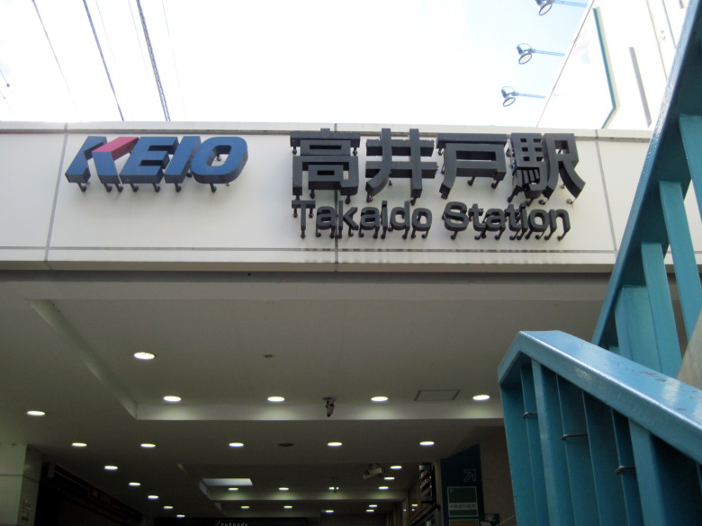
Takaido Station
I arrived at Takaido Station.
Walking data
Course: JR Chuo Line Kichijoji Station -> Kanda River -> Keio Inokashira Line Takaido Station
Distance: 6.3km
Time: 1h34m


コメント