
It is a precious experience to be able to walk along the waterfalls. In today’s course, you can walk along two of the three famous waterfalls in Oku-Nikko, Yutaki and Ryuzu-no-Taki. And it’s free. There is almost no climbing, so I recommend it.
Oku-Nikko Yumoto Hot Spring
Before I left, I was told by the staff of the inn that Emperor Kinjo was evacuated to the Nanma Hotel in Oku-Nikko Yumoto Hot Spring during the war when he was the Crown Prince. The former site of the Nanma Hotel is now the Ohururi Sanso.
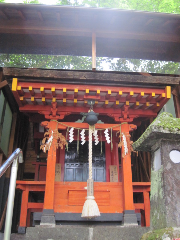
Hot Springs Shrine
I checked out and left. First, I paid a visit to the hot spring shrine. The deity of the shrine is Ohnamuchi-no-mikoto, also known as Okuninushi-no-mikoto.
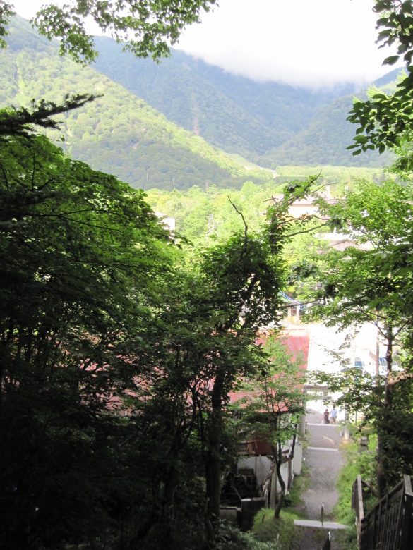
View from the Hot Spring Shrine
It was pretty high up, but the trees were sticking out from the sides, so the view wasn’t as open as I expected.
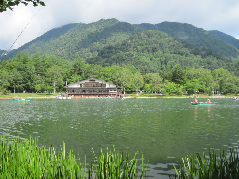
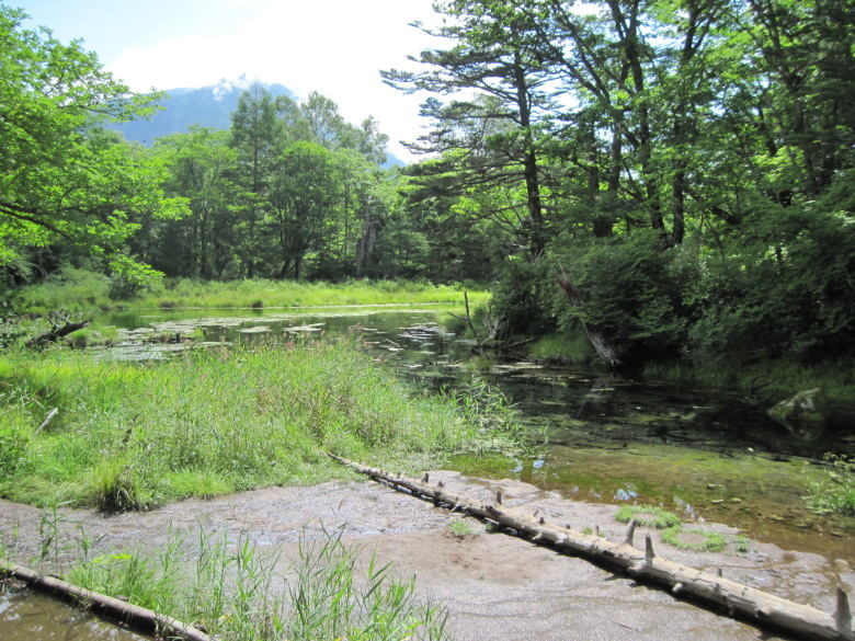
Nikko Yumoto Rest House seen from Usagi Island
I first walked halfway around Lake Yunoko in a clockwise direction from the north. On the way, I stopped at Usagi island, which is a peninsula. From Usagi island, you can see the Nikko Yumoto Rest House.
There were many fishermen there in the morning.
Yutaki waterfall
I went out to the Yutaki waterfall.
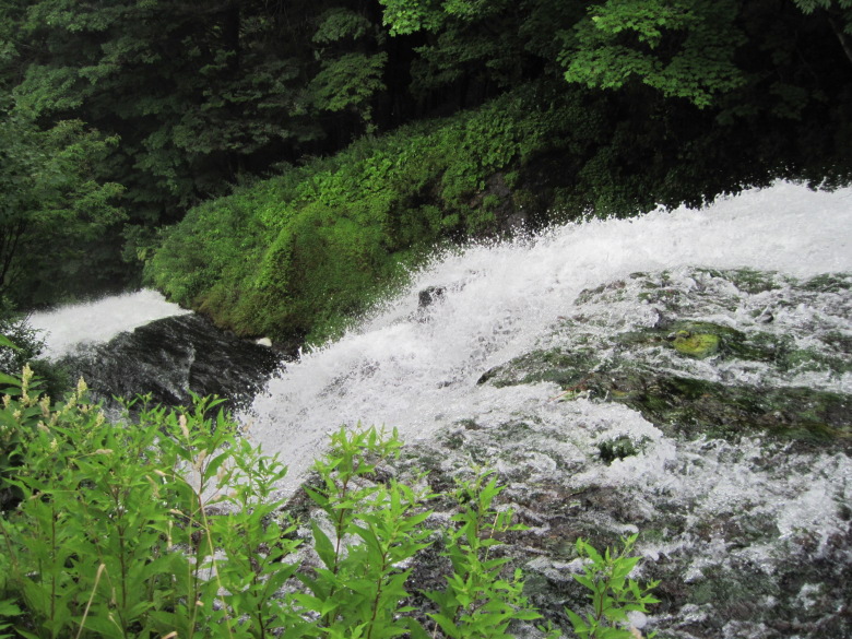
Yutaki Waterfall seen from above
This is the beginning of the fall. This might be the first time in my life to go down along such a large waterfall.
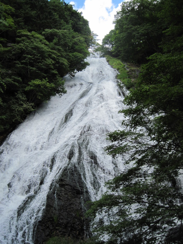
Yutaki Waterfall
Some sites say the drop is 50 meters, while others say it’s 70 meters. It’s pretty out there.
Looking at the topographic map, it looks like the drop is from 1,480m to 1,420m. I don’t mean to take the middle of the road, but I think my theory is 60 meters.
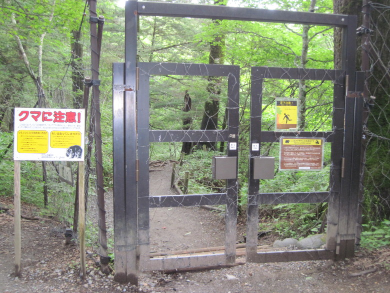
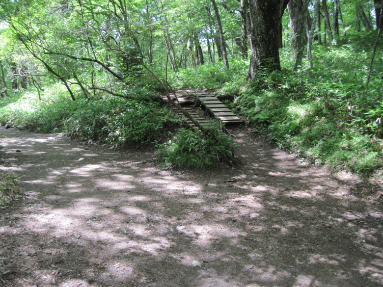
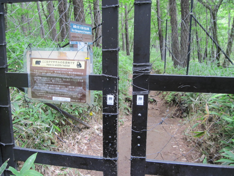
Detour entrance gate
From here, I head toward Senjogahara. The trail on the right bank is closed to traffic until Friday, August 31, 2008. Therefore, you will have to take the detour on the left bank.
There is a sign by the entrance of the gate that says “Beware of bears.” I’m not too happy about opening the gate.
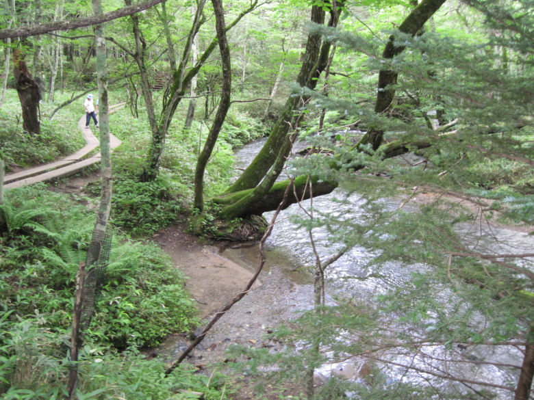
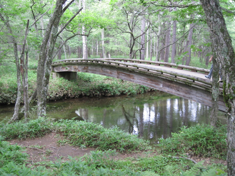
Yugawa River and wooden path
The detour is maintained as a wooden path.
I’m sorry that you have to go through it for free.
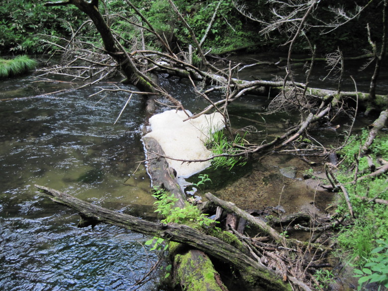
Bubbles floating in the Yukawa River
There are bubbles on the surface of the water in some places. There is a theory that this is caused by the sugar content of Elodea nuttallii, which grows in Lake Yunoko.
Izumiyado Pond
When I reached Izumiyado Pond, Mount Nantai came into view. The summit was covered with clouds, so we could only see a little bit of it.
There were many benches here, and everyone was taking a break and taking pictures.
Senjogahara
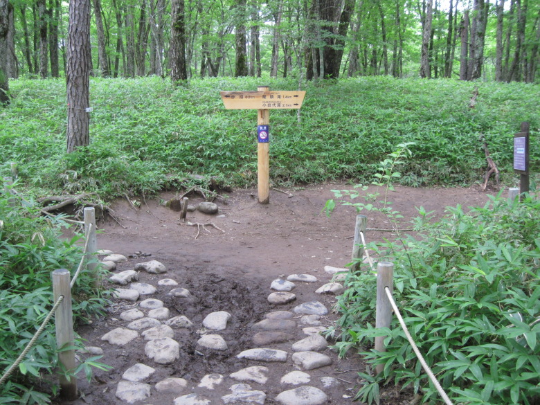
The junction of the path to Odashirogahara and the path to Senjogahara
This is the junction of the path to Odashirogahara and the path to Senjogahara.
This is an unassuming fork in the road, but if you make a mistake, the distance you have to walk will change drastically, so be careful.
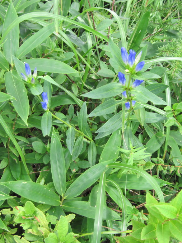
Gentiana
I found a gentian. It is still a bud, but it has a beautiful color.
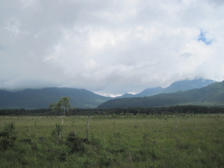
Senjogahara
We came to Senjogahara, named after the place where Mt. Nantai and Mt. Akagi were transformed into a giant snake and a giant centipede, respectively, and fought over the territory of Lake Chuzenji.
The mountain in the foreground on the right with only its left base visible is Nantai (2,486m), the medium-sized mountain with a cloud on its peak is O-Manako (2,376m), and the small mountain to its left with a cloud on its peak is Komanako (2,323m). To the left of which the summit is just barely clear of clouds is an unnamed mountain of 2,034m, and the relatively large mountain with its right base visible to the far left is Tarou (2,368m).
So the eldest daughter’s Mount Omanako is higher than the eldest son’s Mount Tarou.
The mother’s Mount Nyho (2,483m) is hidden from view by Mount Omanako.
The junction of the Akanuma and Ryuzu Falls directions
A little more than 2km after reaching Senjogahara, the road divides into the Akanuma direction and the Ryuzu Falls direction.
I wanted to go to Ryuzu Falls, but I wanted to go to the restroom, so I headed toward Akanuma.
At the Akanuma teahouse, I had some soft-serve ice cream. It was a delicious soft-serve ice cream with a thick taste like condensed milk.
Although I had a free bus pass, I decided to walk to Ryuzu Waterfall because the bus might be late and I might not be able to sit down.
Yukawa Akanuma Bridge
When I returned to the previous junction, I found that the Yukawa Akanuma Bridge that I had passed when coming out of Senjogahara matched the surroundings, creating a tasteful landscape.
Ryuzu Waterfall
Passage gate
Again, there was a gate with a sign warning against bears and monkeys.
I was not too happy to open this gate.
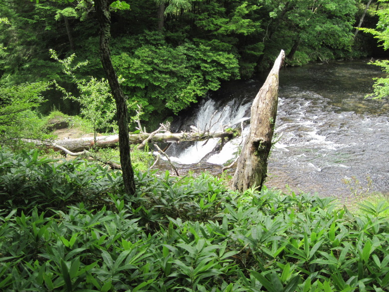
Ryuzu Falls seen from above
After walking about 1.5 km from the Yugawa Akanuma Bridge, the Yugawa River begins to fall. This is the beginning of Ryuzu Falls.
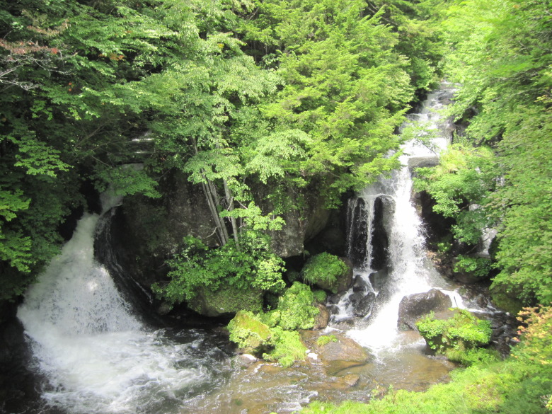
Ryuzu Falls
This is the waterfall as seen from the Teahouse of Ryuzu.
The elevation of Ryuzu Falls drops from 1,340m to 1,300m, so the drop is probably about 40m, although some websites say 60m. It may be difficult to discuss the drop for a waterfall that has a staircase.
I had to return to Tokyo a little early, so I finished my walk and took a bus from the Ryuzu-no-taki bus stop.
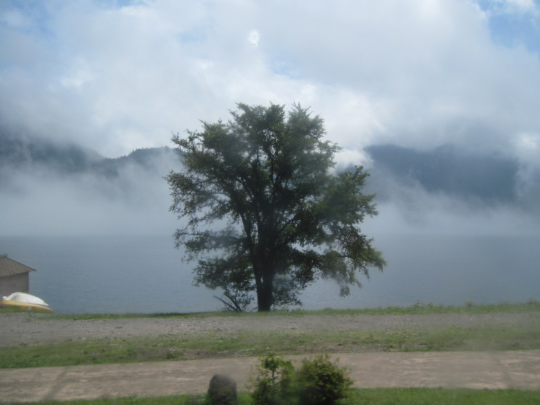
Lake Chuzenji in the fog
On the way, Lake Chuzenji was foggy and fantastic.
Walking data
Course: Oku-Nikko Yumoto Onsen -> Yutaki -> Ryuzu Falls -> Ryuzu Falls bus stop
Distance: 9.6km
Time: 3h36m

