Strolling around in hot Tokyo, I felt like I was going to get heat stroke, so I escaped to Nikko.
It was quite hot in the sunlight too, as I walked along the mountain path.
Tobu Line
The limited express platform on the Tobu Line in Kita-Senju is difficult to understand. If you are a first time user, you don’t know that half of the platform and the rest of the platform is for limited express trains.
Did they divide the platform into front and back because it is too narrow and dangerous for commuters?
If that’s the case, I wish they would be more creative with the signage. Only the limited express trains are color-coded, which makes it difficult to understand. I think it would be easier to understand if there were arrows and a sign next to the arrows that said “100 meters ahead”, using the same color scheme as other trains.
Also, on the departure time display board, the departure time of the limited express is written, but there is no information on the platform. I think it would be much easier to understand if there was a note next to the time, such as “The express platform is near Nikko on the main platform.”
I got on an earlier train than I was supposed to, so I asked the station staff and got on without any trouble, but if the train had been on schedule, I would have missed it for sure.
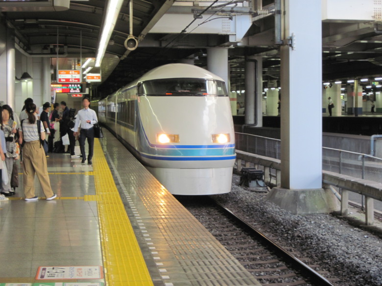
Express kogon
I took the 7:42 “Kegon No. 5” train from Kita Senju to Tobu Nikko.
Nikko Route Bus
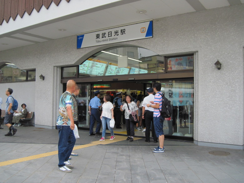
Tobu Nikko Station
At Tobu Nikko Station, I got a 3,000 yen Yumoto Onsen Free Pass. With this, I could ride the bus as much as I wanted for two days.
The bus arrived, but since it was tourist season, there were many people and we couldn’t sit down.
Luckily, however, there were people getting off at Shinkyou and I was able to sit down.
As I approached the Iroha-zaka slope, the train climbed steadily up the slope from “I” to “Ro”. But just before the “Ha”, I heard a “popping” sound in the back left corner…
Was it a flat tire?
The driver immediately stopped the car, announced “Please wait a moment,” and then went outside to check. The air conditioner was working, and the car was calm.
He came back a couple of minutes later and said, “If you can move it, I’ll try to move it slowly. That’s the instruction from the company,” the broadcast said. But after a while, it didn’t move a muscle. We can’t move it because it’s lost pressure. A replacement bus is being arranged and will be here in 10 minutes.” The passengers, who had been prepared to wait for tens of minutes, were relieved.
Within ten minutes, a bus arrived, overtook the one we were on, stopped, and we walked over to it. It was a rare and precious experience for me.
However, because it was not an empty bus, people who were standing had to sit down, and people who were sitting had to stand up. There was one female passenger who raged, “Why don’t you turn the empty bus around?” but the others were nonchalant.
I wondered if the broken-down bus had been towed away. Iroha-zaka is a one-way street, so you have to go all the way to the top at least once, right?
Hiking to Kirikomi Lake and Karikomi Lake
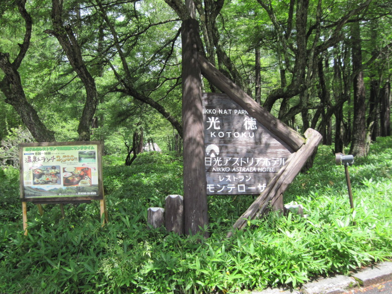
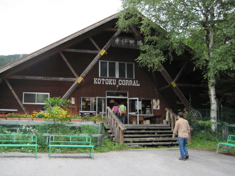
Kotoku
We arrived at Kotoku. The altitude is about 1,430 meters.
Since I was going to go hiking at Kirikomi-ko and Karikomi-ko, I went to Nikko Astoria Hotel first and tried to eat something. However, the restaurant was still closed, so I bought some sweets (5 Kinu no Seiryu Tochiotome in a bag) at the store to eat during the hike.
The store also had bells to keep bears away, but I didn’t buy any because I thought there were so many people on the trail that bears wouldn’t come out.
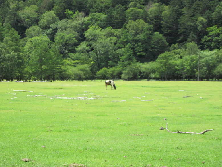
Kotoku Farm
Cows were slowly grazing at Kotoku Farm, about 300 meters west of the hotel.
Kotoku Farm store
The store at the farm sold bread, so I bought one.
I also had some ice cream and drank some milk since I would not be coming back here. Usually, this ranch seems to be the last place people go and make it a reward.
The ice cream was regular vanilla ice cream on a cone. I felt the milk was a little thicker than commercial milk.
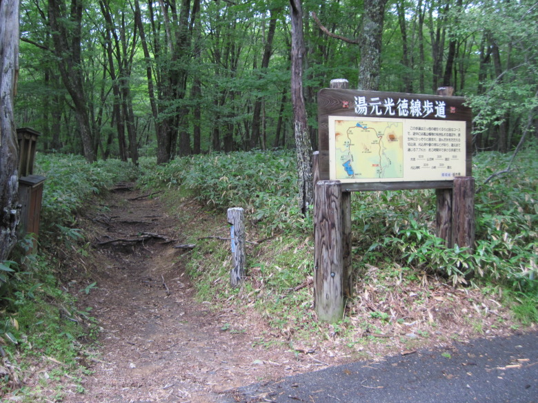
Yumoto Kotoku Line sidewalk entrance
The start of the hike.
I thought the path would be soggy from the recent rains, but it was not, and it was quite dry, which was a relief.
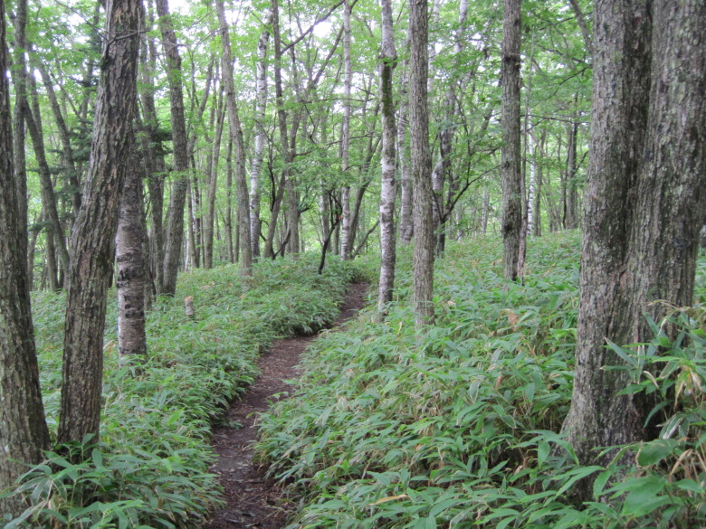
A path of kuma-zasa and birch
I guess it’s kuma-zasa. At the beginning, the trail is gentle, but it continues to climb through a birch forest.
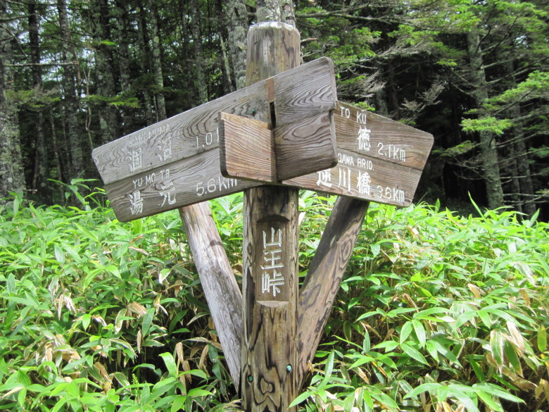
Sanno Pass
I reached the Sanno Pass almost an hour after I started climbing. It says that it is 2.1km to Koutoku, so it took twice as long as it would have on flat terrain.
The elevation of the Sanno Pass is 1,741 meters. This means that I have climbed roughly 310 meters.
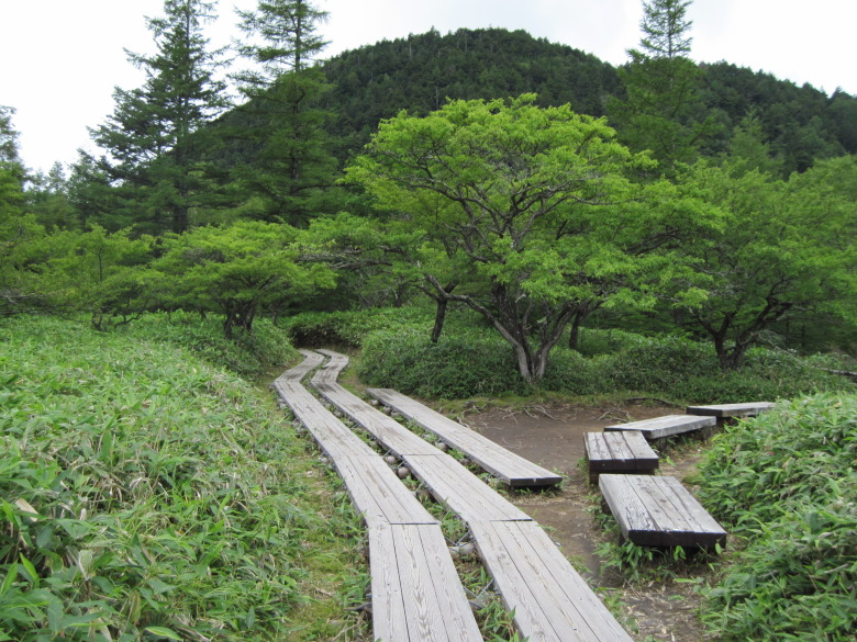
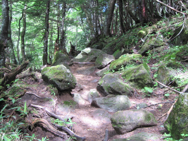
Well-maintained sidewalks
The path from the pass is well marked with footpaths, just like Oze.
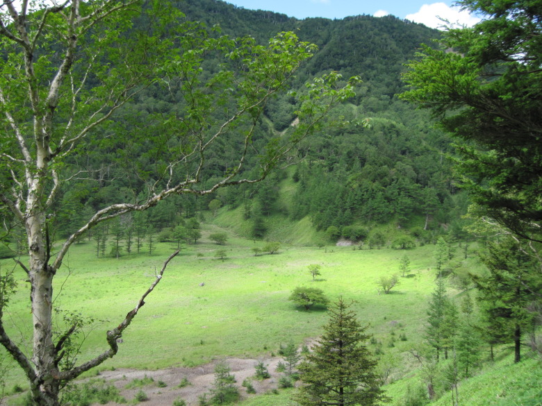
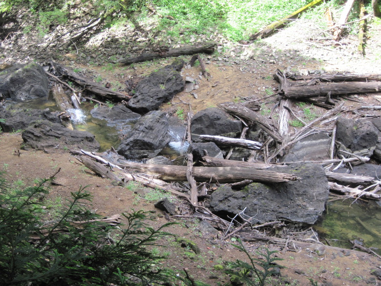
Karenuma Swamp
We are now at Karenuma Swamp. In the upper left corner of the photo, the head is cut off, but it’s Orogurayama at an altitude of 2,020 meters. I’m not familiar with this word. It may be of Ainu origin.
Looking at the photo, it looks like a quiet landscape. But in reality, the cicadas are chirping loudly.
There were also a lot of dragonflies flying around, and when I was taking pictures, they would stop at my hands without my permission.
There are benches in the dry riverbed, so I took a rather late lunch break.
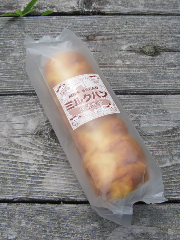
Milk bread bought at Kotoku Farm
The bag of milk bread I bought at Kotoku Farm was very flat, probably because of the low air pressure.
The altitude around here is 1510 meters. The Sanno Pass was 230 meters higher than here, so I wonder if the bag was even fuller.
The milk bread was delicious, so I ate a lot of it. I noticed that I only had 250ml of water left. I should have bought another bottle of water at Kotoku.
There were quite a few people in the dry river bed. Nearly half of them were wearing bells to protect them from bears.
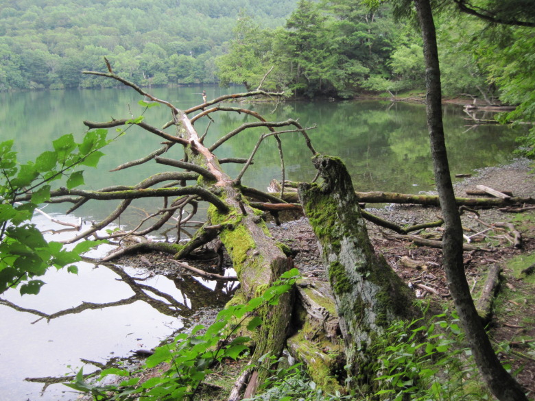
Road with little elevation gain from Karenuma Swamp
From Karenuma Swamp, the trail continues with not much elevation gain. However, there are mossy fallen trees and mossy stones strewn underfoot.
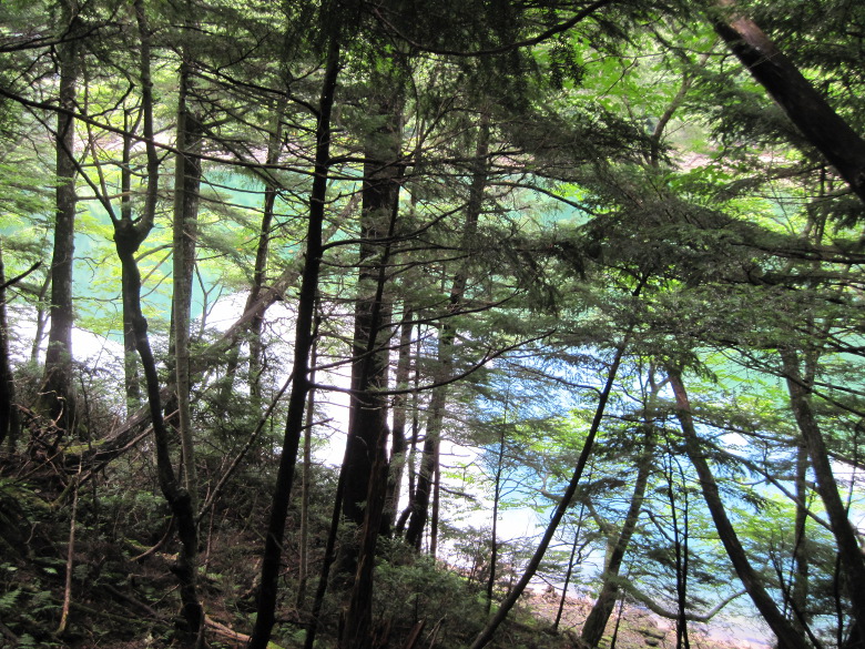
Kirikomi Lake
After about half an hour, I could see Kirikomi Lake through the trees.
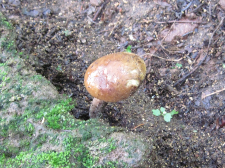
Mushroom
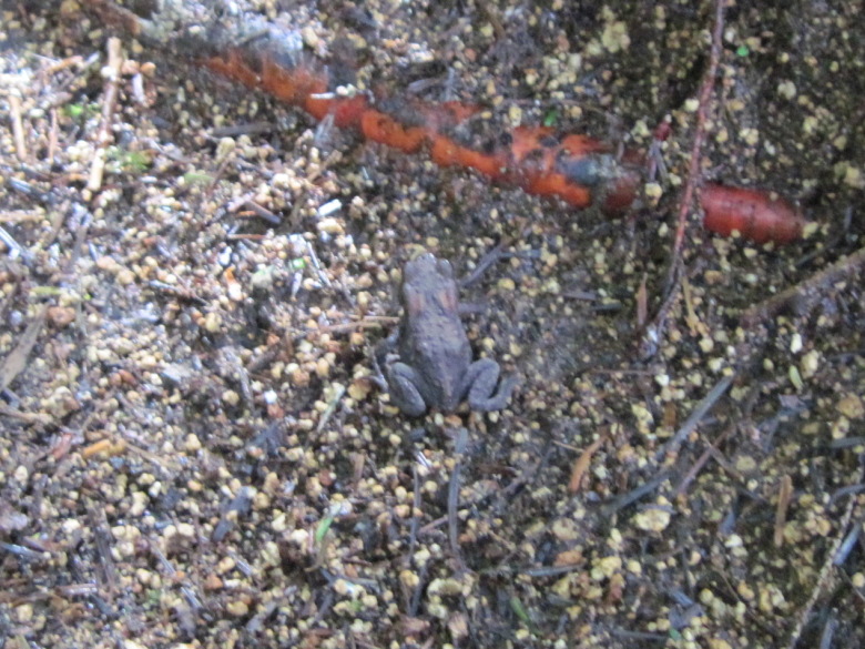
Frog
I saw mushrooms and frogs.
切込湖と刈込湖の接続部
Lake Kirikomi and Lake Karikomi are subtly connected. Water was flowing from Lake Karikomi to Lake Kirikomi.

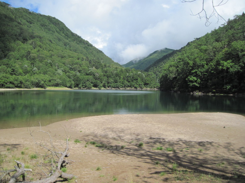
The sky reflected in Karikomi Lake
This photo is a bit confusing for a moment, but it shows the sky reflected on the surface of Lake Karikomi. The weather forecast was not so good, but it turned out to be fine.
Lake Karikomi is a bit of a strange lake as there doesn’t seem to be any rivers flowing into or out of it. The water in Lake Karikomi was cold, but not surprisingly so.
Karikomi Lake
On the other side of Lake Karikomi, the low point between the mountains on either side is Kanata Pass, which used to be a road leading to Kuriyama Village, but is now abandoned.
After taking a 25-minute break at Lake Karikomi, I started walking and the climb was hard.
The stairs were well maintained and the path was easy to climb, but my legs almost cramped up.
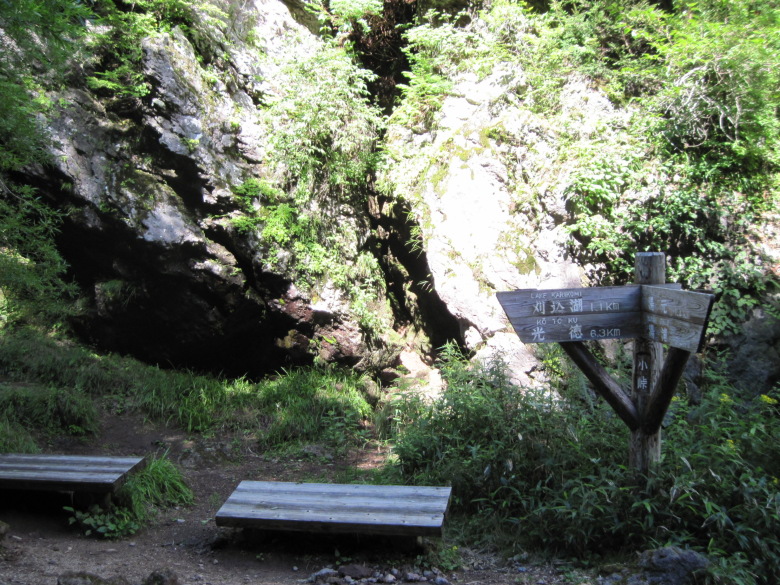
Kotoge
The altitude at Kotoge is 1,672 meters, and at this point you can smell hydrogen sulfide (the so-called rotten egg smell), indicating that a hot spring is near.
Oku-Nikko Yumoto Onsen
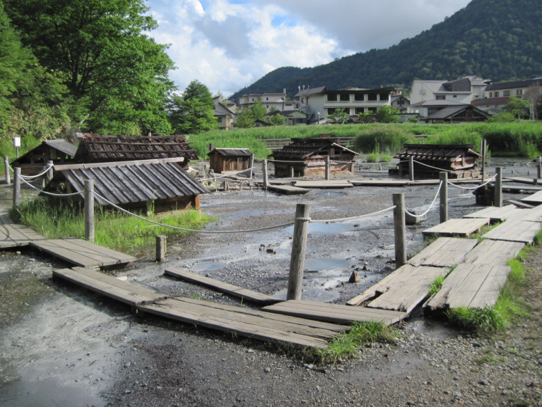
The source of Yumoto Onsen
Crossing the Romantic Road of Japan, you will come to the source of Yumoto Onsen.
A number of huts have been built, and the hot spring water is drawn from here to each ryokan.
When I put my hand in the puddle at my feet, it was warm.
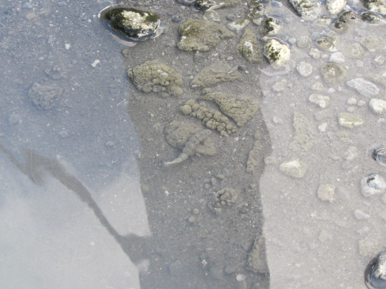
Larvae of the soldier fly
In the midst of all this, I found insects about five centimeters long that seemed to be the larvae of the soldier fly.
I was staying here in Oku-Nikko Yumoto Onsen today, so I checked into the inn.
But since I had an hour before dinner and the surrounding area was still bright, I decided to go around Lake Yunoko.
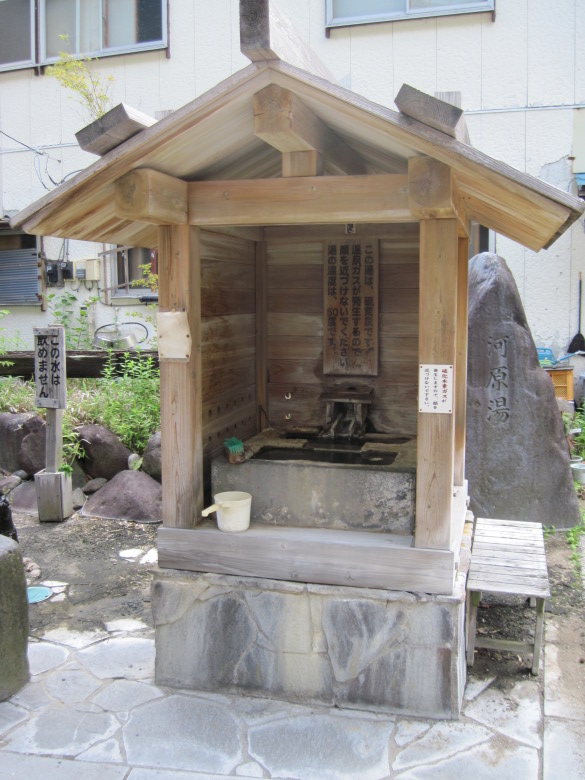
Kawara-yu
On the way from the ryokan to Yunoko, I found a Kawara-yu! There is a hand bucket, but there is no drain at my feet, and I don’t know how to use it. I would appreciate it if you could write down the instructions.
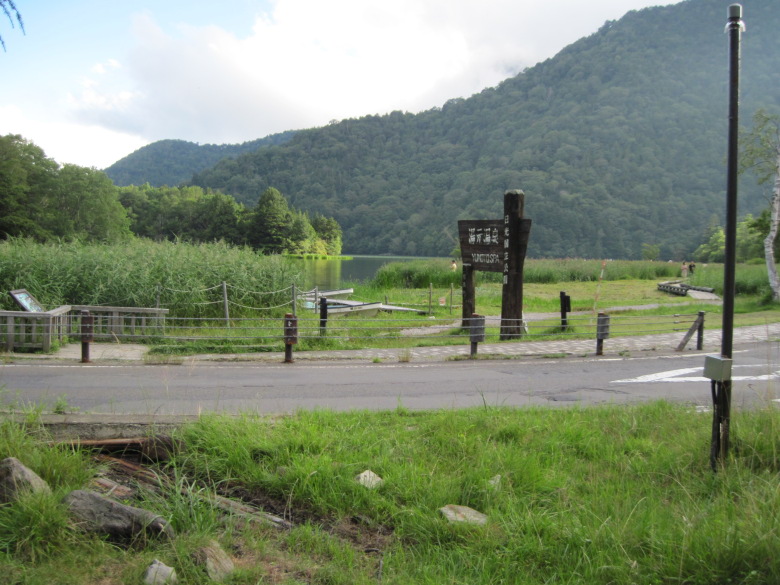
Yunoko
There were quite a few people fishing at Lake Yunoko.
I was surprised to see a girl who seemed to be in the upper grades of elementary school practicing fly fishing.
I guess this is how the locals get so good at it.
Lake Yunoko seen from the circular walkway
I went counterclockwise around Lake Yunoko, and when I came to the southwest part of the lake, Japanese monkeys came out to the sidewalk and were looking for food. There were also baby monkeys, and they were cute.
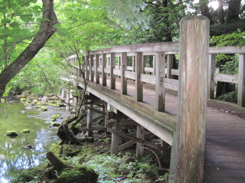
Wooden bridge on the Yunoko
About halfway around, I came to a bridge. It leads to Yutaki, but I’ m looking forward to seeing it tomorrow.
Walking data
Course: Kotoku Onsen/Nikko Astoria Hotel -> Karenuma Swamp, Kirikomi/Karikomi Lake -> Yumoto Onsen
Distance: 13.4km
Time: 6h21m