There are many places in Tokyo that people talk about. But the one in Nihombashi, where COREDO Nihombashi is located, has been in the news and talked about so many times that it seems to be exceptional.
The marathon for the 2020 Tokyo Olympics will be run in front of this building.
Around 6.5km

Suidobashi Station (East Exit)
The name of the area south of Suidobashi Station is Misaki-cho.
Before the Edo period (1603-1867), the shallow sea called Hibiya Inlet extended to this area, and Misaki-cho used to be a cape jutting out into Hibiya Inlet.
The marathon course is no match for the 15-meter-high Surugadai, so at the east exit of Suidobashi, turn right from Sotobori Dori to Hakusan Dori, and head south along the eastern edge of the original Hibiya Inlet.
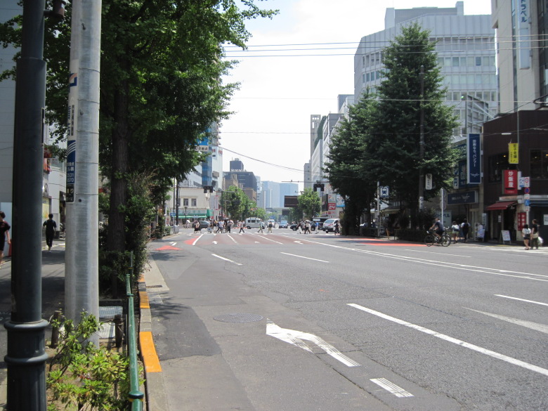
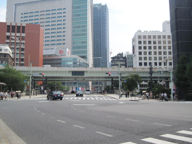
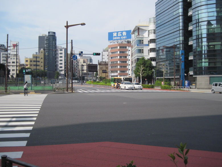
Intersection at Jimbocho
After about 700 meters, I came to the Jimbocho intersection. This is where many people are crossing in the picture. The Hibiya Inlet continued all the way beyond.
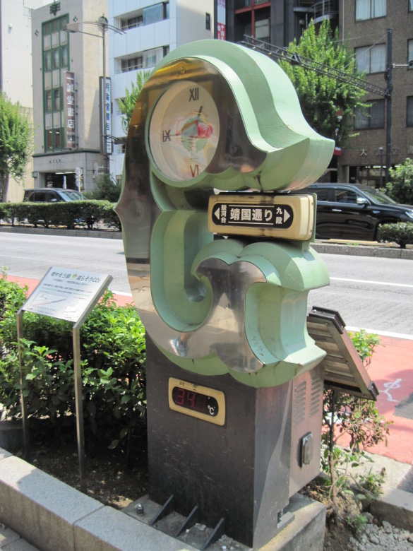
Thermometer showing 34 degrees Celsius
As I turned left at the Jimbocho intersection, I saw the thermometer. It’s over 34 degrees Celsius, not quite the 35 degrees Celsius that defines a hot day, but it’s extremely hot.
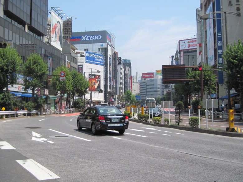
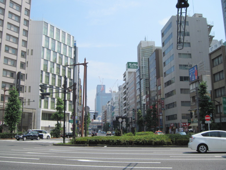
Yasukuni Avenue
This is Yasukuni Street. In the marathon course, this is about 7.5km point. Actually, the 3-4km point was also through Yasukuni Street.
Why didn’t you go through Yasukuni Street all the way, but through Sotobori Street or Hakusan Street?
It is probably because they don’t want to go through the steep slope from Yasukuni Shrine (about 25m above sea level) to Kudanshita (about 8m above sea level).
By the way, I think the reason why Yasukuni Street curves to the right in this picture is because they designed the road to avoid the Surugadai ridge which is coming out from the left.
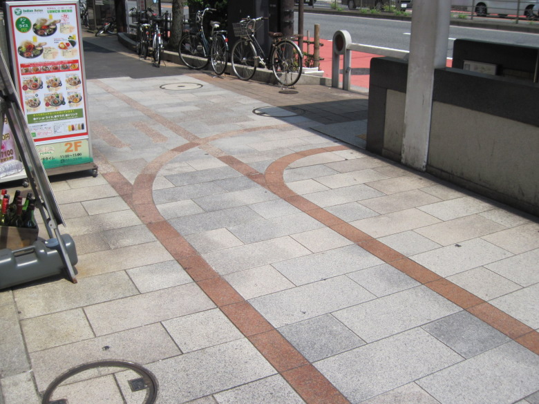
Sidewalk near Ogawa-machi
I have passed by the sidewalks around Ogawamachi many times. But only today, the pattern of the sidewalk caught my attention. Doesn’t it look like a railroad track? Could it be that the streetcars used to run around here?
Apparently so. It seems that the streetcar line 12, which connected Shinjuku and Ryogoku, used to run along Yasukuni Street.
Suda-cho intersection
This is the intersection of Sudacho. Here, you turn right from Yasukuni Street on the right side of the picture to Route 17 (Chuo Street) at the back of the screen. The streets don’t intersect at right angles, so it’s a big, snarky turn.
I wonder if the players will make the turn honestly without complaining.
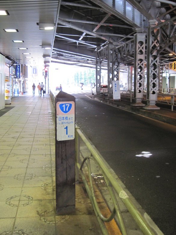
1km kilometer post
There was a 1km kilometer post under the JR guard. Since Nihonbashi is the 10km point of the marathon, this is about the 9km point.
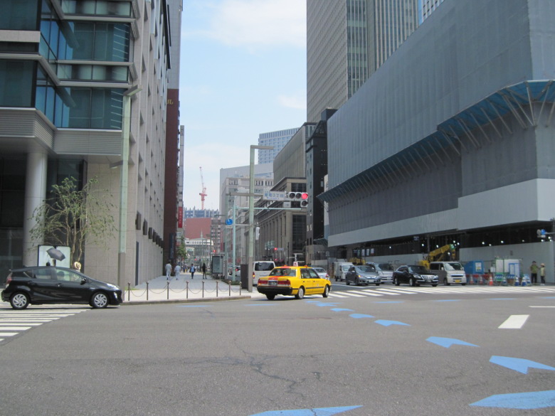
Muromachi 3-chome intersection
At the Muromachi 3-chome intersection, Route 4 joins the road from the left. You can see Nihonbashi in the distance. No, you can’t. You can see the expressway running over the bridge.
Around 10km
Nihombashi
I came to Nihombashi.
The highway that passes over Nihombashi will soon be underground, so this photo may become valuable.
Passing through Nihombashi, I turn left at the Nihombashi intersection onto Eitai-dori Street.

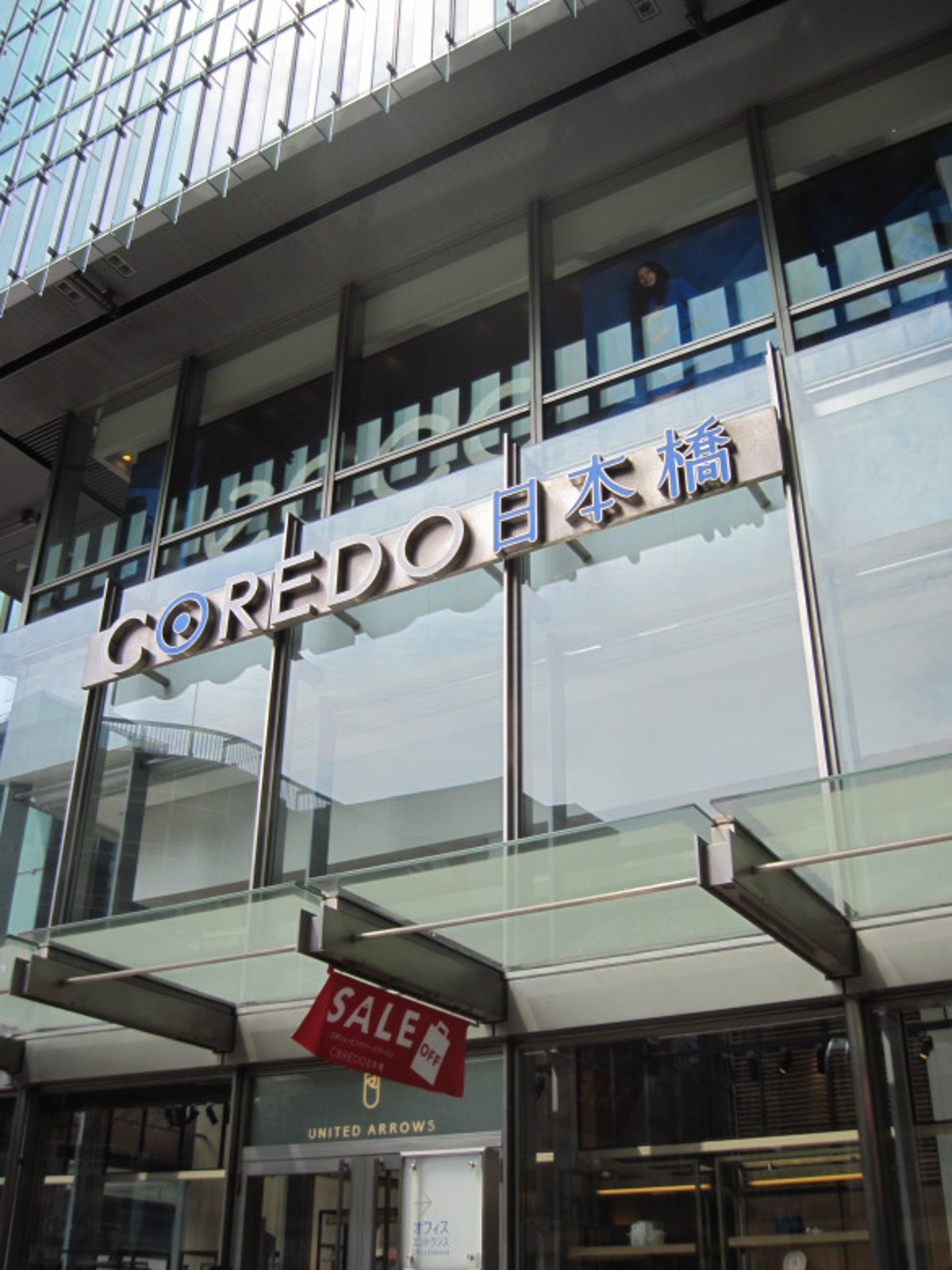
COREDO Nihonbashi
Then we found COREDO Nihonbashi!
There used to be a department store here called Shiroki-ya, and on the third floor was the Tokyo Tsushin Kenkyusho, the predecessor of Sony… I’m sure the athletes will run silently without thinking about any of that.
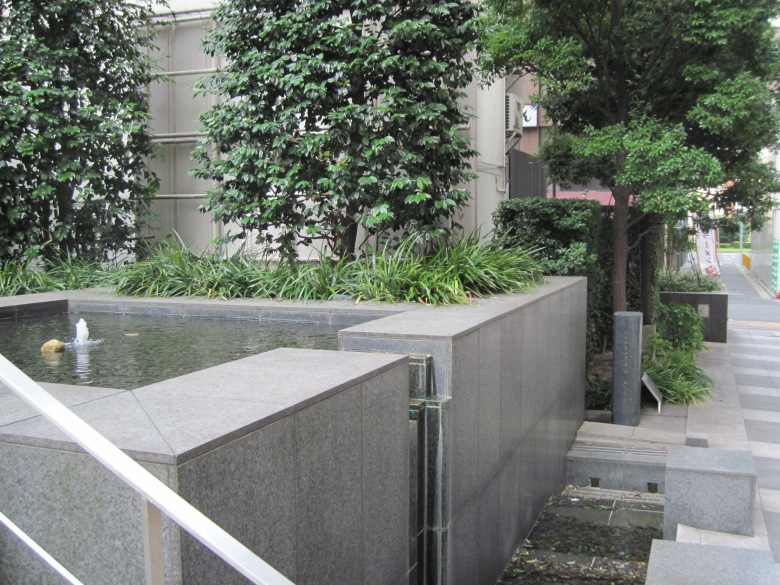
The famous water Shirakiya’s Well
I took a short detour to see the famous Shirakiya well behind COREDO.
In this area, where the sea is so close and digging only yields salt water, a well with fresh water seems to have been very valuable. The well was said to have dried up, but there was a fountain that looked like it could be used for a short break. In front of the tree on the right is a monument to the well.
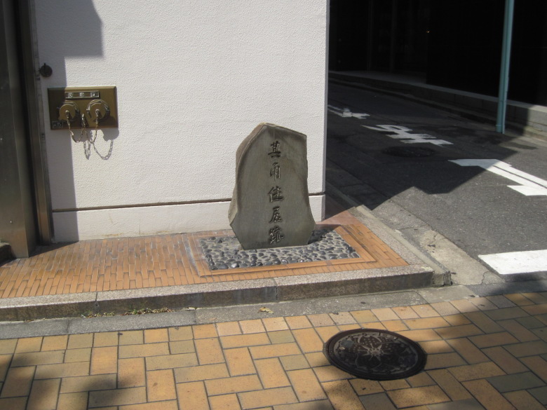
Kikaku Residence Site
I found a stone monument that says “Kikaku Residence Site”!
Takarai Kikaku. I heard he was a haikai master. I don’t know what kind of person he was, so I’d like to learn a little about him before I pass by here again.

Kayabacho 1-chome intersection
At the intersection of Kayabacho 1-chome, turn left from Eitai-dori to Shin-ohashi-dori. It was only 630 meters through Eitai-dori.
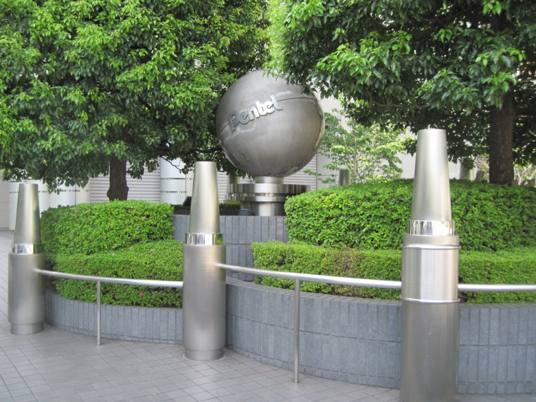
Objects at Pentel Headquarters
After crossing the Nihonbashi River, I found Pentel’s headquarters. There was an object that looked like a crayon. If an ordinary person designed it, they would probably use primary colors, but the way the metal is polished gives it an expression. I like this design a lot.
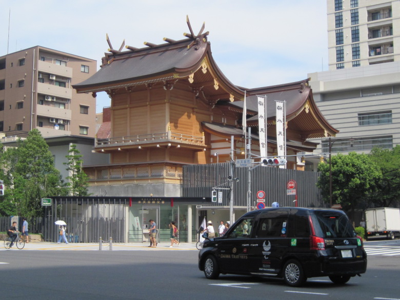
Suitengu Shrine
A new large shrine has appeared on a very high place. This is Suitengu Shrine. By the way, it had been under construction for a long time. They moved to the new shrine in April of the year before last (2016). And this year is the 200th anniversary of the shrine’s establishment.
At the Hamacho-Nakanobashi intersection, where you turn from Shin-Ohashi Street to Kiyosubashi Street, I forgot to take a picture.
Actually, I was thinking and passed by the intersection. I was wondering why the two streets crossed each other at right angles when both the Shin-Ohashi Bridge and the Kiyosubashi Bridge span the Sumida River. That’s the question. When I looked at the map, all I saw was a right-angle bend in the Sumida River. I was convinced.
Kiyosubashi-dori
As soon as I entered Kiyosubashi-dori, I looked up and spotted the words “Weightlifting Hall.
It’s a high place, and I’m worried that the floor will fall out.
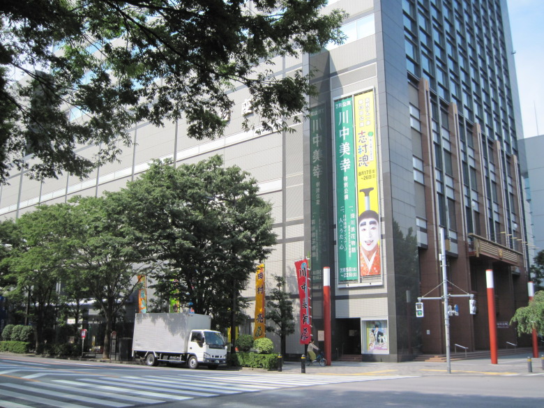
Meiji-za Theater
This is the Meiji-za Theater. If I see such a banner while I am running, I wonder if some runners will get a pain in their side from laughing and quit running. I am very worried.
Higashi Nihonbashi intersection
There is a tree growing in the middle at the Higashi Nihonbashi intersection.
If you want to go from the right hand side to the back, do you have to go around the tree from the left in a big circle? It looks like a tight curve.
Around 13km
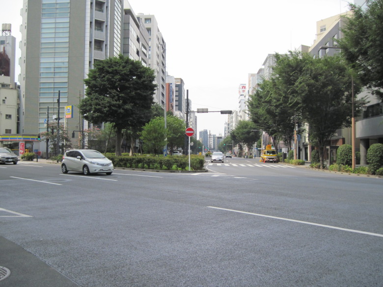
Asakusabashi intersection
This is the Asakusabashi intersection. After passing through this intersection, you will meet Route 6 coming from the left.
There are no sidewalks at the end of the crossing, so use the underpass to cross Route 6.
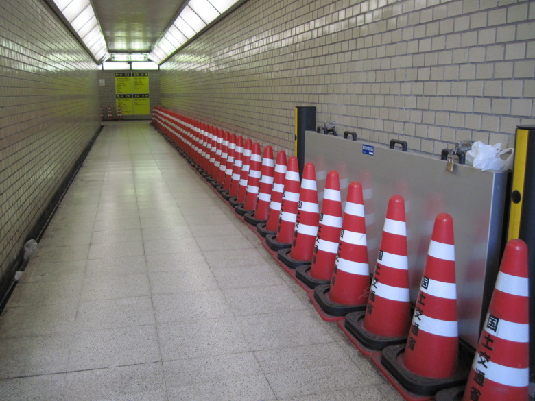
Inside the Underground Passage
This is the interior of the underpass. Colored cones were lined up in a well-behaved manner.
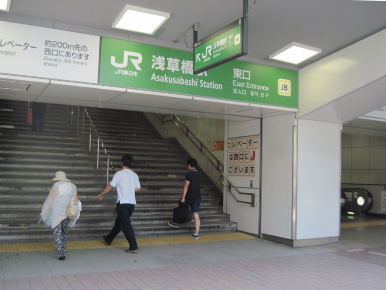
Asakusabashi Station
Today’s walk was to Asakusabashi Station, about 13 km away.
Walking data
Course: JR Chuo Line Suidobashi Station -> 6.5km point -> 13km point -> JR Chuo Line Asakusabashi Station
Distance: 7.3km
Time: 2h7m

