I took it a little easy today.
I always walk from Tokyo to Nagano, but today, I walked in the opposite direction. As for the elevation of the Koshu Kaido, I had to go down about 220 meters from 730 meters to 510 meters.
It was a rather cold day, and the ice in the puddles did not melt even though it was almost noon. In one puddle, the ice formed a pattern that looked like contour lines.
Tsutagi-juku
I started walking from Shinano Sakai Station.
The elevation at Shinanosakai Station is 920 meters, and it takes about 2.5 kilometers to descend all the way down to Kamitsutagi, 730 meters above sea level.
Once we reach the Koshu Kaido road, we will head towards Kofu. It may sound bad to say that we avoided the climb, but it sounds good to say that we are heading in the same direction as the Ochatsubodouchu.
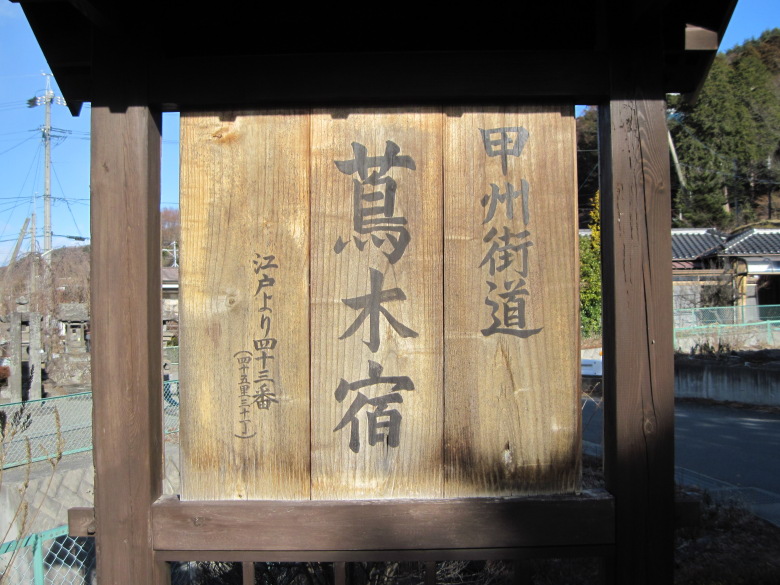
Signboard of Tsutagi-juku
After about 300 meters, I came across a sign for the Tsutagi-juku. The Tsutagi-juku was a juku with the atmosphere of yesteryear. I should have taken more pictures of the streets.
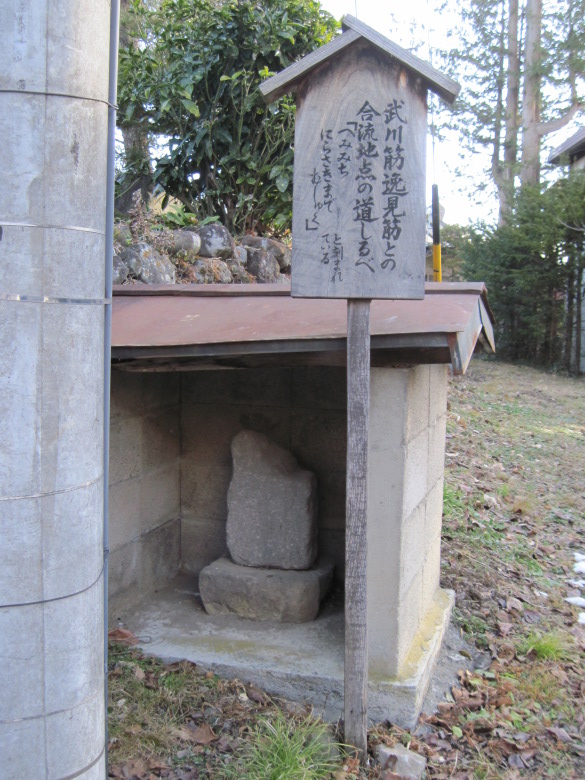
Hemimichi nirasaki made mushu
About 600 meters before Kokkai-bashi Bridge, there is a signpost inscribed with the words, “Hemimichi nirasaki made mushu.” From here to Nirasaki, it’s a straight line distance of 23 kilometers.Isn’t there a place to stay along the way? I wonder what would happen if you got sick on the way. I think it would have taken a lot of determination to go. I didn’t know the way, so I decided not to go.
Kokkai-bashi Bridge
This is the border between Nagano and Yamanashi prefectures on the Kokkai-bashi Bridge.
The name of the river at the border between the two prefectures is the Kouroku River. It is a river that flows along the valley from Amigasa Mountain in the Yatsugatake mountain range. It is not a very wide river.
Kyoraishi-juku
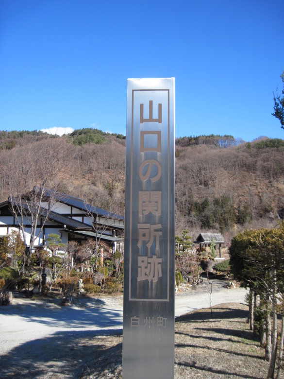
Remains of the Yamaguchi barrier
I found the remains of the Yamaguchi barrier!
It seems to be a rather open land for a barrier station.
However, it may have been a natural defensive fence, as a stream flows nearby orthogonally to the Koshu Kaido.
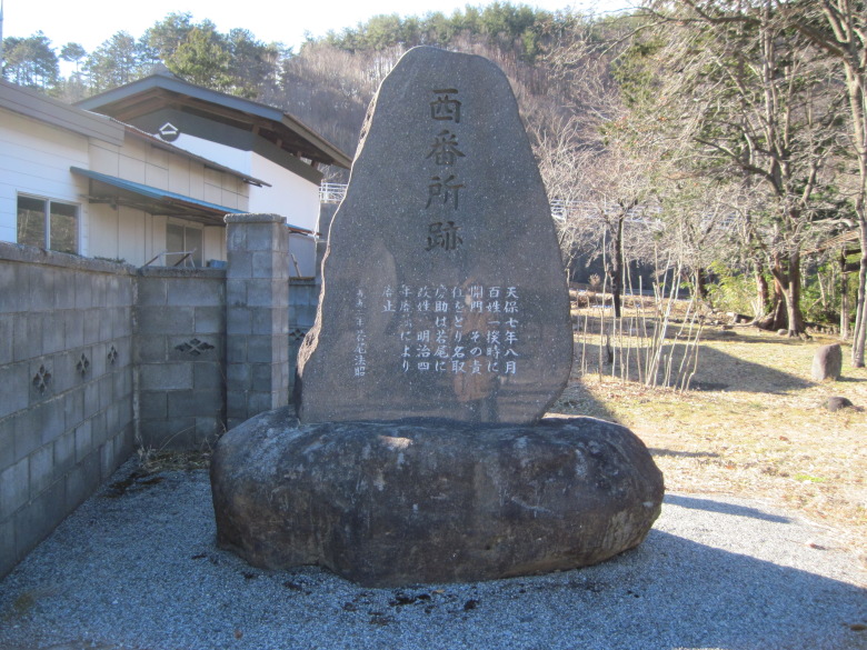
Ruins of the west guardhouse
Not far from the ruins of the barrier, I found the ruins of the west guardhouse. There is a magnificent stone monument that is more tasteful than the ruins of the barrier.
It says that Natori Hikosuke took responsibility for opening the gate during the peasant revolt and changed his name to Wakao. Does that mean he took the responsibility? I’m not sure, so I’d like a more detailed explanation.
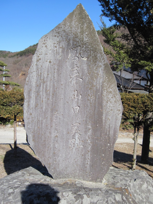
Site of the Horai-Yamaguchi barrier
Soon, I found another magnificent stone monument. It read, “The site of the Horai-Yamaguchi barrier.” I guess this is the stone monument of the traditional barrier.
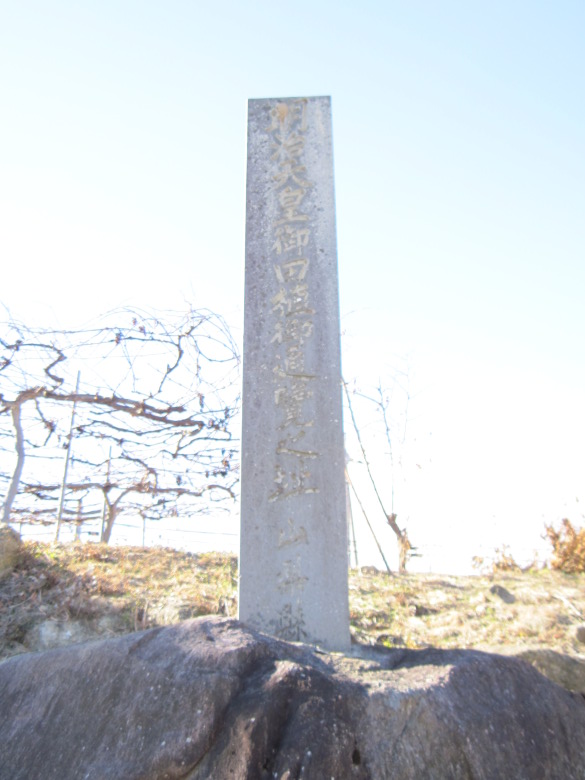
Remains of the place where the Meiji Emperor observed rice planting
Near Suwa Shrine in Shimokyouraishi, I found the remains of the place where the Meiji Emperor observed rice planting! With trepidation, I visited the site from the same location, but there was no one working on the farm at the end of the year.

Ice with contour pattern
Found a puddle of ice near the Jingu River with a pattern that looked like contour lines!
I’ve never seen such beautiful patterns before.
First, the surface of the water must have frozen, with thicker ice around the perimeter and thinner ice in the center.
Next, the water in the puddle must have been absorbed by the soil, and the air must have accumulated in the center where the ice was less thick. Then, the boundary between air and water froze, creating the first stripe in the center.
Furthermore, as water is absorbed by the soil, air also enters the outside of the first stripe, and the boundary with the surrounding water freezes, forming the second stripe. In this way, multiple stripes may have been created.
I couldn’t find a site with an explanation on Google, so I just thought of something.
Daigahara-juku
I came to Daigahara. What surprised me was that there were several old inns still in business. If the atmosphere is as good as Daigahara, I would like to stay there.
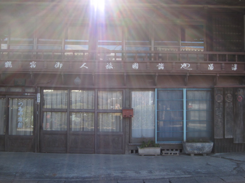
Tsuruya Ryokan
This is the “Tsuruya Ryokan”. From the right, it says, “Tsuruya Shokoku Tabibito Onshukuruya (Tsuruya, an inn where travelers from all over the country come and stay).” The bill on the lower right is also very interesting.
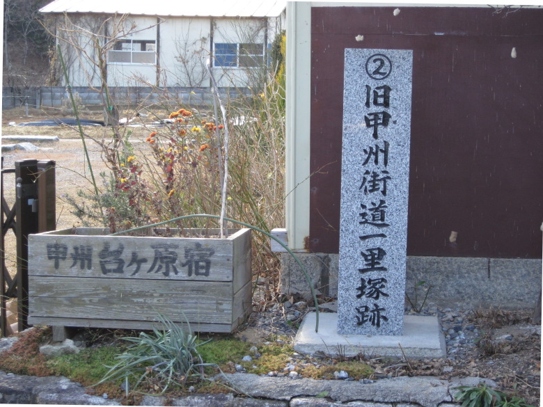
Daigahara Ichirizuka
There was the site of Daigahara Ichirizuka. What is “2”?
I also took a picture of the Shichiken House, which served as the Emperor Meiji’s place of residence, but I did not get permission to post it here.

One hundred best roads in Japan: Koshu Kaido
“The town of Daigaharajuku, a juku on the Koshu Kaido Highway,” has been selected as one of the 100 best roads in Japan.
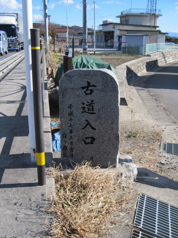
Ancient Road Entrance
After passing through the streets of Daigahara and crossing Route 20, the entrance to the old road appears. If you turn right here, you can walk along the banks of the Ojira River. It is also recommended to drive to Daigahara and walk here for a while. As I said, I don’t have any photos. I wonder why I didn’t take any pictures.
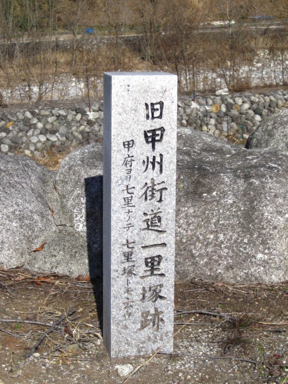
Remains of Mifuki Ichirizuka
The remains of Ichirizuka (Mifuki) appeared. What? It’s very close to the Daigahara Ichirizuka. One ri is about four kilometers, but it’s only about two kilometers away. There is a note saying, “This is a distance of 7 ri from Kofu, so it is called Shichirizuka.” I hypothesized that people in the old days were measuring from various points and became confused, so they placed Ichirizuka without the distance of one ri. Do you think this hypothesis is correct?
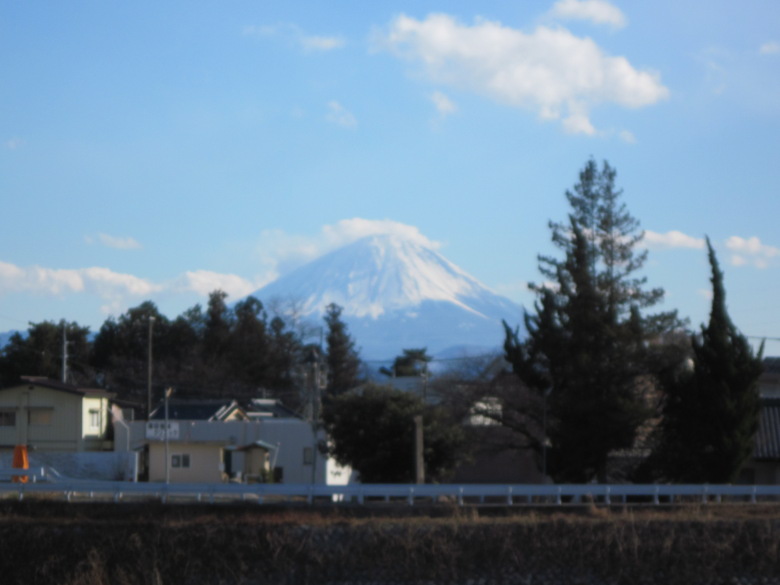
Mt. Fuji seen from near the Omukawa Bridge
Just before the Omukawa Bridge, I got a good view of Mount Fuji in the southeast direction.
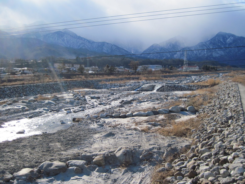
Cloud-covered Southern Alps
However, the Southern Alps to the west were covered with clouds. On a clear day, we would have been able to see Mount Kai Komagatake over the Omukawa River.
At the end, the 90-meter climb from the 510-meter-high Omukawa River to the 600-meter-high Hinoharu Station was pretty tough.
Walking data
Course: JR Chuo line Shinano Sakai -> Tsutagi-juku -> Daigahara-juku -> JR Chuo line Hinoharu station
Distance: 20.7km
Time: 6h8m

